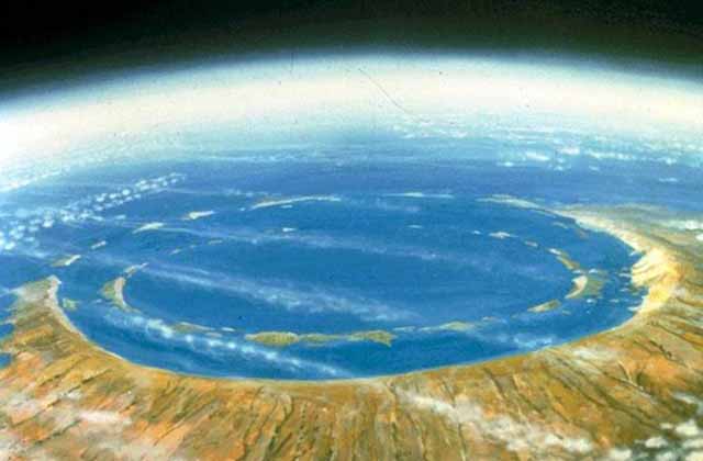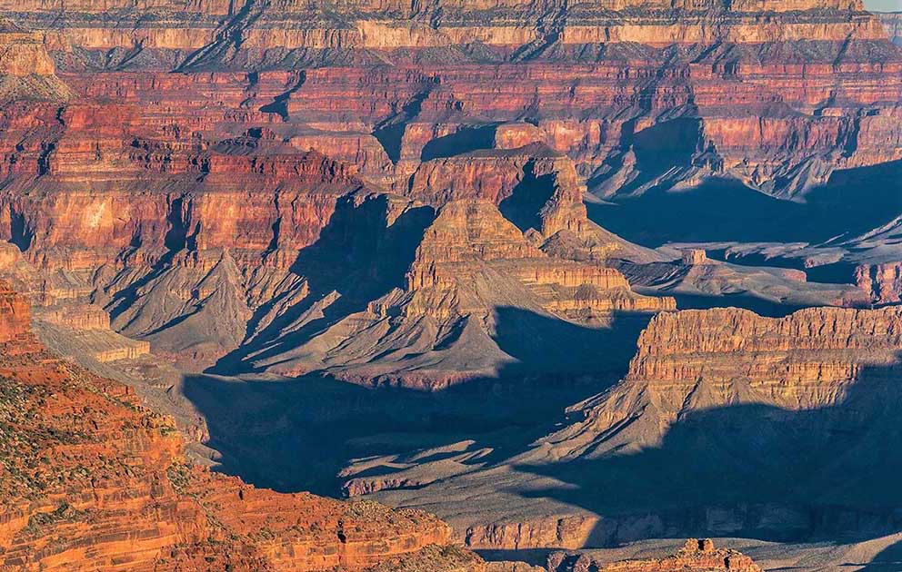
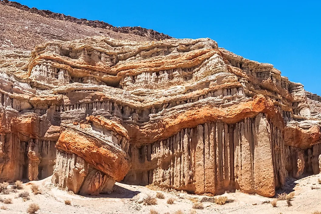
Geology is that branch of natural science concerned with Earth and other astronomical objects, the rocks of which it is composed, and the processes by which they change over time. Modern geology significantly overlaps all other Earth sciences, including hydrology. It is integrated with Earth system science and planetary science.
Geology describes the structure of the Earth on and beneath its surface, and the processes that have shaped that structure. Geologists study the mineralogical composition of rocks in order to get insight into their history of formation. Geology determines the relative ages of rocks found at a given location; geochemistry (a branch of geology) determines their absolute ages. By combining various petrological, crystallographic and paleontological tools, geologists are able to chronicle the geological history of the Earth as a whole. One aspect is to demonstrate the age of the Earth. Geology provides evidence for plate tectonics, the evolutionary history of life, and the Earth's past climates.
Geologists broadly study the properties and processes of Earth and other terrestrial planets. Geologists use a wide variety of methods to understand the Earth's structure and evolution, including field work, rock description, geophysical techniques, chemical analysis, physical experiments, and numerical modeling. In practical terms, geology is important for mineral and hydrocarbon exploration and exploitation, evaluating water resources, understanding natural hazards, the remediation of environmental problems, and providing insights into past climate change. Geology is a major academic discipline, and it is central to geological engineering and plays an important role in geotechnical engineering. Read more
Geology is an earth science that studies the solid non-living terrestrial features of the Earth or of other natural satellite such as the moon. The discipline is particularly concerned with studying the rocks, minerals, and other materials that make up the Earth and how relevant processes have altered them as time moves forward.
Scientists who study geology, known as geologists, aspire to explain how the earth looks like on and beneath the surface as well as all the processes involved in shaping it. Using established and proven techniques, geologists are able to tell the approximate ages of rocks on and below the earth as well as explain the histories of the rocks. Ultimately, it is possible to determine the history of the earth itself using geology through the power of its combined tools and techniques. Some of the more well-known histories unearthed by geologists include the proof of plate tectonics, past climate of the earth, as well as evolution itself.
Geology is applied in several things like the location of natural resources such precious minerals and petroleum by economic geologists. Other fields where it is applied include engineering, hydrology, and studying natural hazards.


A concretion is a hard and compact mass formed by the precipitation of mineral cement within the spaces between particles, and is found in sedimentary rock or soil. Concretions are often ovoid or spherical in shape, although irregular shapes also occur. The word concretion is borrowed from Latin concretio '(act of) compacting, condensing, congealing, uniting', itself derived from concrescere 'to thicken, condense, congeal', from con- 'together' and crescere 'to grow'. Descriptions dating from the 18th century attest to the fact that concretions have long been regarded as geological curiosities. Because of the variety of unusual shapes, sizes and compositions, concretions have been interpreted to be dinosaur eggs, animal and plant fossils (called pseudofossils), extraterrestrial debris or human artifacts. Read more ...

Romania's trovants: The bulbous 'living' rocks that inspired folkloric tales of dinosaur eggs and aliens. They can grow and reproduce as though they were living. Live Science - February 9, 2025
The Wave is a sandstone rock formation located in Arizona, United States, near its northern border with Utah. The formation is situated on the slopes of the Coyote Buttes in the Paria Canyon-Vermilion Cliffs Wilderness of the Colorado Plateau. The area is administered by the Bureau of Land Management (BLM) at the Grand Staircase-Escalante National Monument visitor center in Kanab, Utah.
The formation is well-known among hikers and photographers for its colorful, undulating forms and the difficult hike required to reach it. Due to the fragile nature of the formation and the large number of people wishing to visit it, a daily lottery system is used to dispense permits for up to 16 people and/or 4 groups (whichever comes first) two days before (visitors must apply within a geofence area encompassing the greater Kanab visitor center, Vermilian Cliffs, and Page areas). Additionally, 48 people and/or 12 groups (whichever comes first) online permits for each date are available four months in advance of a planned trip. A map and information about the hike are supplied to those who have obtained permits. Continue reading
The Wave Of Arizona Is A 190-Million-Year-Old Geological Masterpiece IFL Science - March 22, 2023
Very few rock features in the world can compare to the Wave in Arizona. With its swirling layers and undulating forms, this trippy rock formation is a geological wonder that's been 190 million years in the making.
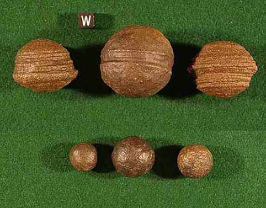
Moqui Marbles, hematite concretions, from the Navajo Sandstone of southeast Utah.
Scale cube, with "W", is one centimeter square.
UNL discovery has implications for finding life on Earth, Mars PhysOrg - August 16, 2012
Moqui marbles, unusual balls of rock that can be found rolling around the southwestern U.S. sandstone regions, were formed roughly 2 million years ago with the help of microorganisms. This discovery by a University of Nebraska-Lincoln research team has implications for finding life on Mars and for better understanding Earth's past. Moqui marbles, which range in size from BBs to cannonballs, weather out of sandstone and have a hard, round shell made of iron oxide, or rust, and a soft, sandy interior. Previous theories of their formation had suggested a chemical reaction devoid of life, but Weber's team discovered clear evidence that microorganisms played a role.
To determine that microorganisms were involved, researchers looked for telltale signs of life, principally nitrogen and organic carbon. Compared to minerals, living beings usually contain a "lighter" isotope of carbon, or one with fewer neutrons, and chemical analyses indicated the presence of this lighter carbon. Looking at the material using a field emission scanning electron microscope, they discovered structures that resembled microorganisms. Nanoscale geochemical analyses conducted by colleagues at the University of Western Australia provided a detailed chemical composition of the structures that further indicate microbial life.
The Navajo Sandstone is also well known among rockhounds for its hundreds of thousands of iron oxide concretions. They are believed to represent an extension of Hopi Native American traditions regarding ancestor worship ("moqui" translates to "the dead" in the Hopi language). Informally, they are called "Moqui marbles" after the local proposed Moqui native American tribe. Thousands of these concretions weather out of outcrops of the Navajo Sandstone within south-central and southeastern Utah within an area extending from Zion National Park eastward to Arches and Canyonland national parks. They are quite abundant within Grand Staircase-Escalante National Monument.
The iron oxide concretions found in the Navajo Sandstone exhibit a wide variety of sizes and shapes. Their shape ranges from spheres to discs; buttons; spiked balls; cylindrical hollow pipe-like forms; and other odd shapes. Although many of these concretions are fused together like soap bubbles, many more also occur as isolated concretions, which range in diameter from the size of peas to baseballs. The surface of these spherical concretions can range from being very rough to quite smooth. Some of the concretions are grooved spheres with ridges around their circumference.
The abundant concretions found in the Navajo Sandstone consist of sandstone cemented together by hematite (Fe2O3), and goethite (FeOOH). The iron forming these concretions came from the breakdown of iron-bearing silicate minerals by weathering to form iron oxide coatings on other grains. During later diagenesis of the Navajo Sandstone while deeply buried, reducing fluids, likely hydrocarbons, dissolved these coatings. When the reducing fluids containing dissolved iron mixed with oxidizing groundwater, they and the dissolved iron were oxidized. This caused the iron to precipitate out as hematite and goethite to form the innumerable concretions found in the Navajo Sandstone.

These concretions are regarded as terrestrial analogues of the hematite spherules, called alternately Martian "blueberries" or more technically Martian spherules, which the Opportunity rover found at Meridiani Planum on Mars. Martian spherules have a blue hue in false-color images released by NASA in 2004. Read more ...
Where do the world's biggest diamonds come from? Geology now has answers PhysOrg - July 21, 2026
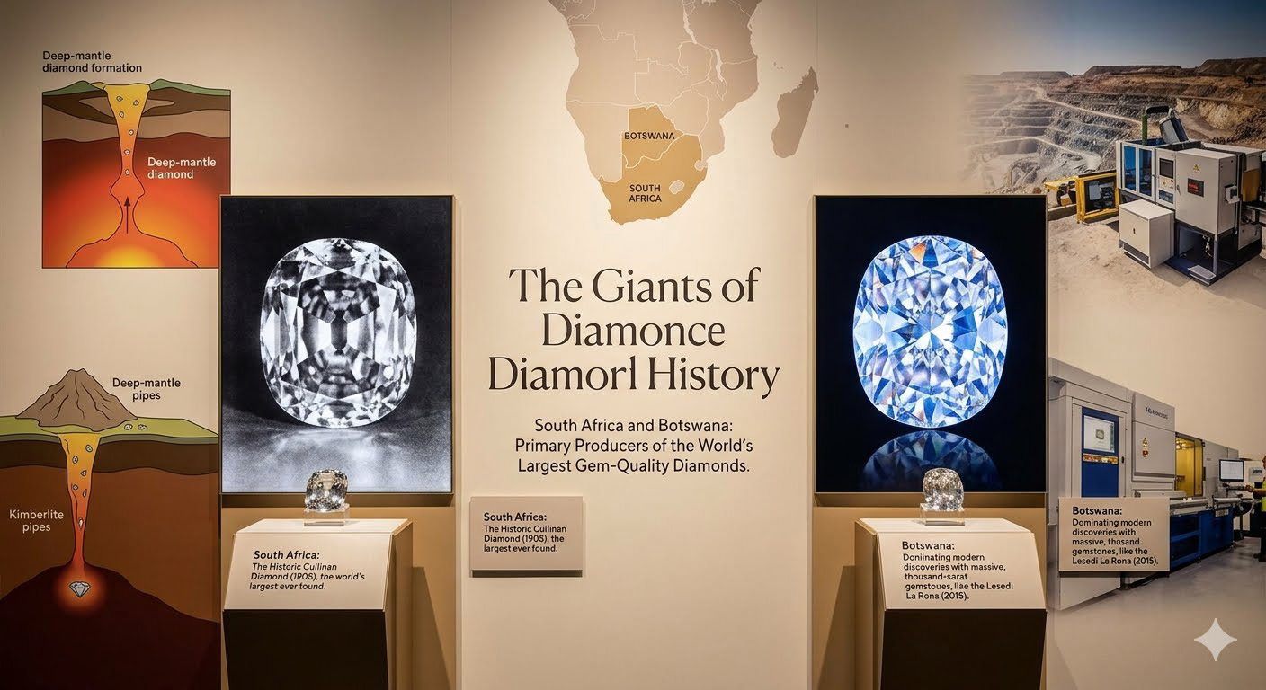
In parts of Africa, including Sierra Leone and Angola, very large CLIPPIR diamonds have been found in river gravels. These diamonds must have come from primary source rocks, such as kimberlites, but in many cases those sources remain unknown. Rivers can transport diamonds far from where they originally erupted, making it difficult to trace them back to the rocks that brought them to the surface. s
Geologists Unearth a Colossal Copper, Gold, and Silver Deposit: The Biggest Mineral Discovery in 30 Years, Worth $424 Billion Daily Galaxy - April 22, 2026
A Canadian miner and one of the world's biggest resource groups are preparing to invest nearly $18 billion in a copper deposit in the Andes that could become the fifth-largest producing mine on Earth if development proceeds as planned. The Vicuna project, straddling the Argentina-Chile border above 4,500 meters, contains 14 million tons of measured and indicated copper, 36 million ounces of gold, and 729 million ounces of silver.
Geologists Reveal the Americas Collided Earlier Than We Thought SciTech Daily - April 15, 2026
Magnetic evidence hints that key tectonic processes in the Andes had already waned, revealing new potential in geophysical methods to decode Earth�s past.
Morocco - Rock Wrinkles Shouldn't Exist - A Geologist's Hike Uncovers a 180-Million-Year-Old Mystery

Preserved seabed ripples on an outcrop in Morocco covered with wrinkle structures thought to be formed by an ancient microbial community from the Early Jurassic. The inset shows a close-up of the wrinkle structures covering the ripples.
Mysterious Pink Rocks Expose a Massive Secret Buried Under Antarctica's Ice SciTech Daily - January 14, 2026
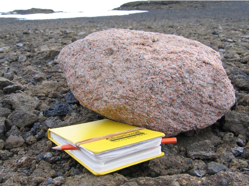
Pink granite boulders scattered across the dark volcanic peaks of the Hudson Mountains in West Antarctica have pointed scientists to a massive granite formation hidden beneath Pine Island Glacier. This buried body spans nearly 100 kilometers (about 62 miles) in width and reaches approximately 7 kilometers (around 4.3 miles) in thickness, making it roughly half the size of Wales in the UK.
Mysterious Structure Identified Beneath Bermuda Could Explain Its Weird Geology Science Alert - December 20, 2025
The islands of Bermuda are a scientific mystery. Not because of the notorious Bermuda Triangle nearby, but because they're perched atop a swollen mass of the Earth's crust that technically shouldn't be there, at least not according to traditional theories.
A Surprising Mathematical Pattern Was Found Hiding in Earth's History Science Alert - September 2, 2025


According to a recent study, events geologists use to distinguish transitions between geological chapters in Earth's story follow a hidden hierarchical pattern, one that could shed light on both past and future tumult. Geological time scales may look like tidy timelines in textbooks, but their boundaries tell a much more chaotic story.
'Hot Blob' Heading For New York Following Ancient Greenland Rift. A vast blob of hot rock moving slowly beneath the Appalachian Mountains in the northeastern US is now thought to be the result of a divorce between Greenland and Canada some 80 million years ago. Science Alert - August 5, 2025

A vast blob of hot rock moving slowly beneath the Appalachian Mountains in the northeastern US is now thought to be the result of a divorce between Greenland and Canada some 80 million years ago. A study by an international team of researchers challenges the existing consensus in both geographical and chronological terms. It was previously thought the breaking up of the North American and African continents was responsible, some 180 million years ago.
The oldest rocks on Earth are more than 4 billion years old PhysOrg - July 7, 2025

To date very little is known about this early chapter in Earth's history, as rocks and minerals from that time are extremely rare. This lack of preserved geological records makes it difficult to reconstruct what Earth looked like during the Hadean Eon, leaving many questions about its earliest evolution unanswered.
A 2.6-Million-Pound Rock Thrown Inland by a Monster Wave Daily Galaxy - June 1, 2025

Hidden in the dense greenery of southern Tongatapu, a limestone monolith named Maka Lahi - meaning 'Big Rock' in Tongan - has quietly testified to a prehistoric cataclysm for thousands of years. Weighing an estimated 1,180 tons and resting over 200 meters from the sea, this colossal boulder has now been confirmed by researchers as evidence of an ancient and immensely powerful tsunami that struck the region approximately 6,900 years ago.
Geologists discover mysterious subduction zone beneath Pacific, reshaping understanding of Earth's interior PhysOrg - September 29, 2024
Scientists uncovered evidence of an ancient seafloor that sank deep into Earth during the age of dinosaurs, challenging existing theories about Earth's interior structure. Located in the East Pacific Rise (a tectonic plate boundary on the floor of the southeastern Pacific Ocean), this previously unstudied patch of seafloor sheds new light on the inner workings of our planet and how its surface has changed over millions of years.
'Golden spike' showing the moment Earth turned into a giant snowball discovered in ancient Scottish rocks Live Science - August 19, 2024

Hundreds of millions of years ago, Earth plunged into a deep-freeze that turned the planet into a giant ball of ice. Now, scientists have discovered rocks marking this moment on a remote archipelago in the Inner Hebrides of Scotland. The rocks, dating to between 720 million and 662 million years ago, provide a rare complete record of the transition between a warm tropical environment and a "snowball Earth," where glaciers encased the globe.
Mysterious Pink Sands in Australia Reveal Hidden Antarctic Mountains Science Alert - June 22, 2024
Joining the dots with ice-flow indicators in the South Australian glacial sedimentary rocks that garnet-rich glacial sands were ground out of the Antarctic mountains - which are yet to see the light of day - by an ice sheet moving north-west during the Late Palaeozoic Ice Age, when Australia and Antarctica were connected in supercontinent Gondwana.
Groundbreaking discovery: How researchers found remnants of Earth's primordial crust near Perth PhysOrg - June 21, 2024

Our planet was born around 4.5 billion years ago. To understand this mind-bendingly long history, we need to study rocks and the minerals they are made of. The oldest rocks in Australia, which are some of the oldest on Earth, are found in the Murchison district of Western Australia, 700 kilometers north of Perth. They have been dated at almost 4 billion years old.
Mysterious Fragments of Glass in Australian Outback Have Cosmic Origins in 5,000 Year Old Meteorite Science Alert - April 7, 2024

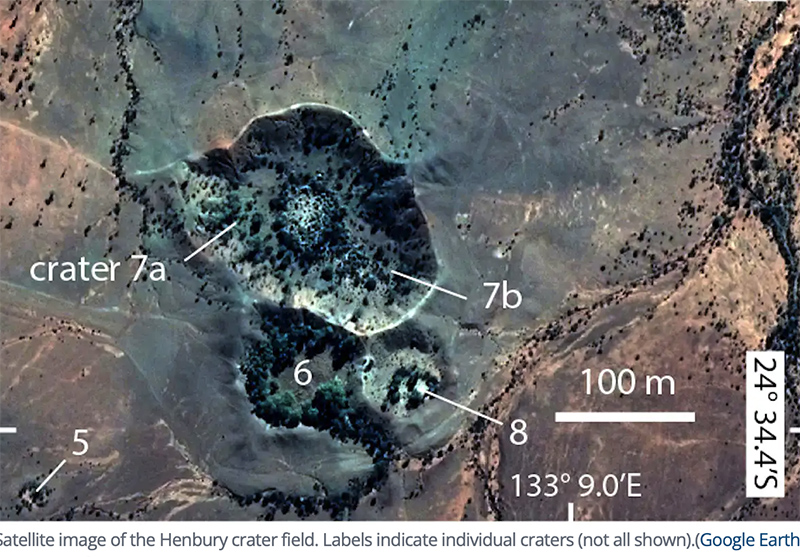
Glass occurs in nature, too. Most of it is obsidian, the glass produced in volcanoes which has been known since ancient times. When the space rock struck at Henbury, the heat of the impact melted the meteorite along with rock from the ground. Some of this fused material formed molten droplets which was thrown from the craters and cooled to form thumb-sized lumps that look a lot like volcanic glass.
Nanoparticles in Some of The World's Oldest Rocks Found in the Pilbara region of Western Australia - Hide Clues on Life's Origins Science Alert - February 3, 2024
Encased inside some of the oldest rocks on Earth are previously overlooked nanocrystals that tell a story about how life might have emerged. Earth scientists at the University of Western Australia and the University of Cambridge say their findings could explain why phosphorus became a major building block of life and how molecules first clicked together to form primitive RNA at hydrothermal vents on the seafloor.
Steamy Stuff At Fly Ranch Geyser IFL Science - September 27, 2023
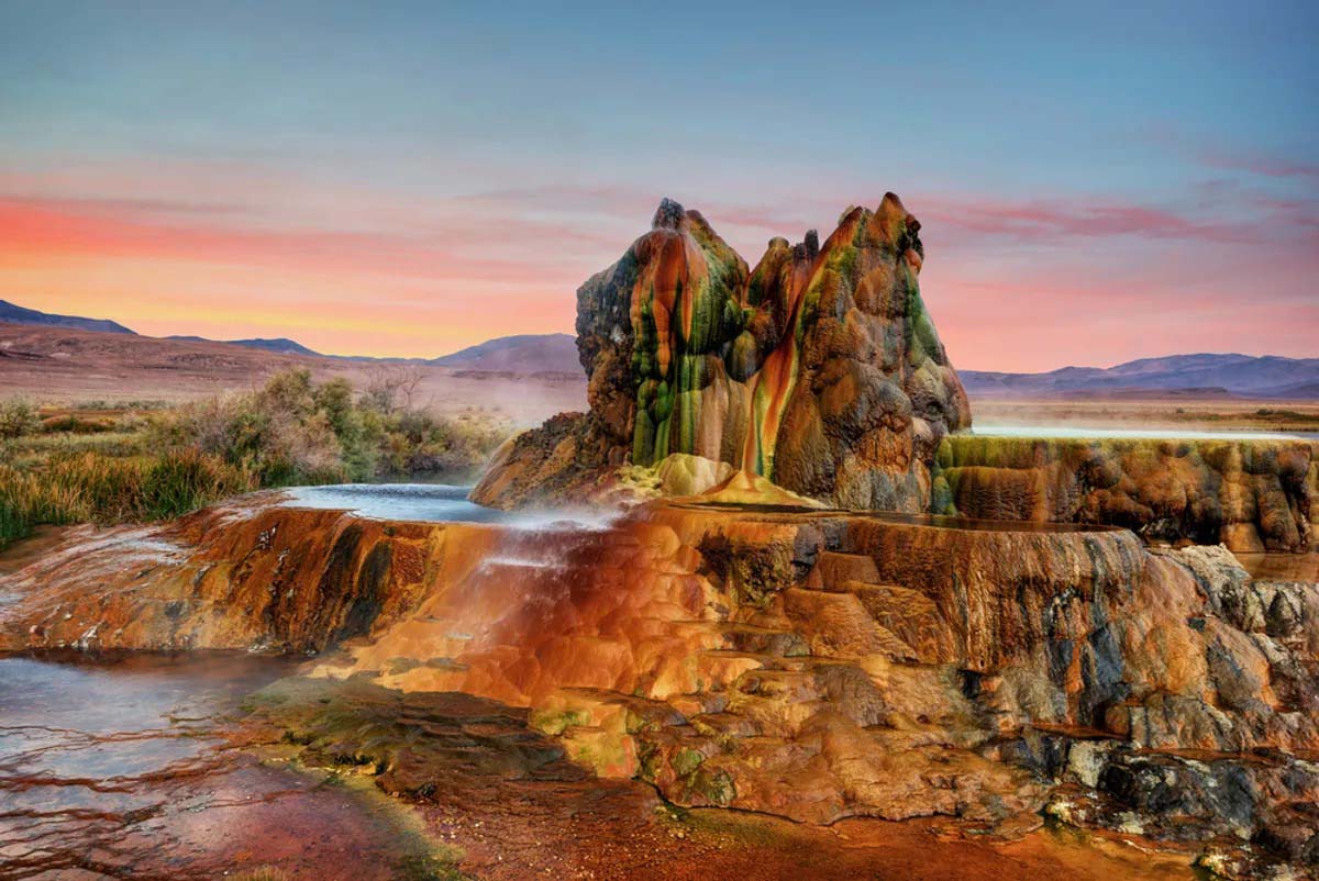
The colorful pic of Fly Ranch Geyser in Nevada is the result of thermophilic algae and mineral deposits. The other-worldly environment sits on the edge of Black Rock Desert.
600-Million-Year-Old Time Capsule Of Ancient Ocean Found In The Himalayas IFL Science - August 2, 2023
Drops of water found inside mineral deposits are the remnants of an ocean that disappeared 600 million years ago. Remarkably, the best place to find the minerals in question is kilometers above sea level. The scientists who found them say the droplets may explain a much-debated event crucial to life as we know it.
Drops of seawater found to contain traces of an ancient world PhysOrg - August 2, 2023
Sea salt hides a secret: tiny droplets of the seawater from which it came, preserving geologic history. To access the tiny droplets, the researchers used a laser to drill holes into the salt crystals and then a mass spectrometer to analyze the different trace elements present. In this research, they focused specifically on the concentration of lithium, a trace element that sustained a seven-fold decrease over the past 150 million years, paralleled by a rise in magnesium to calcium ratios.
Nuclear testing in the 1950s marked sediments at the bottom of a lake in Canada to such an extent that scientists are calling for it to become the symbol of a new geological epoch: the Anthropocene Live Science - July 17, 2023

Fallout from these tests snowed down from the atmosphere and became trapped in the earth as layers of sediment rich in a radioactive form of plutonium, called plutonium-239. Scientists argue that blankets of plutonium-239-rich sediment at the bottom of a small lake in Canada present the earliest tangible record of human activities shifting the balance of natural systems - which is why they're naming this potential new epoch "anthro" after humans.
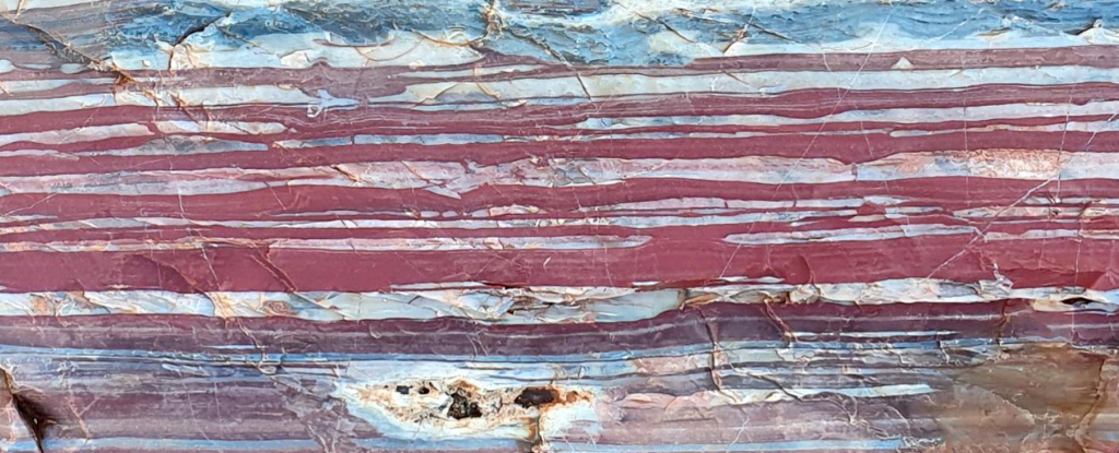
Iron-rich rocks unlock new insights into Earth's planetary history PhysOrg - May 26, 2023
Visually striking layers of burnt orange, yellow, silver, brown and blue-tinged black are characteristic of banded iron formations, sedimentary rocks that may have prompted some of the largest volcanic eruptions in Earth's history,
Potentially Alive 830-Million-Year-Old Organisms Found Trapped in Ancient Rock Science Alert - May 16, 2022
An incredible discovery has just revealed a potential new source for understanding life on ancient Earth. A team of geologists has just discovered tiny remnants of prokaryotic and algal life � trapped inside crystals of halite dating back to 830 million years ago.
Brazil: Rock collector finds rare gemstone that looks like Cookie Monster Live Science - January 27, 2021

What wobbling rocks can tell us about nuclear safety BBC - October 1, 2020
We've all seen them; we've even taken pictures of ourselves pretending to hold them up or to push them over. These are the precariously balanced rocks on a hill or a coastal cliff. It's as if the gentlest nudge would send them tumbling. In truth, the disturbance needed to unsettle the blocks is quite significant, and that got husband and wife geologists Drs Dylan and Anna Rood wondering about how these great stones could be used to decipher earthquake history.
Think about it: if a precariously balanced rock has held its position for 10,000 years without tipping over, it means the land around the stone hasn't experienced shaking above a certain level in all that time.
A billion years missing from geologic record: Where it may have gone Science Daily - May 11, 2020
The geologic record is exactly that: a record. The strata of rock tell scientists about past environments, much like pages in an encyclopedia. Except this reference book has more pages missing than it has remaining. So geologists are tasked not only with understanding what is there, but also with figuring out what's not, and where it went.
Diamond samples in Canada reveal size of lost continent BBC - March 21, 2020
Canadian scientists have discovered a fragment of an ancient continent, suggesting that it was 10% larger than previously thought.
They were studying diamond samples from Baffin Island, a glacier-covered land mass near Greenland, when they noticed a remnant of North Atlantic Craton. Cratons are ancient, stable parts of the Earth's continental crust. The North American Craton stretched from present-day Scotland to North America and broke apart 150m years ago. Scientists chanced on the latest evidence as they examined exploration samples of kimberlite, a rock that often contains diamonds, from Baffin Island.
Geologists find lost fragment of ancient continent in Canada's North PhysOrg - March 20, 2020
Sifting through diamond exploration samples from Baffin Island, Canadian scientists have identified a new remnant of the North Atlantic craton - an ancient part of Earth's continental crust. A chance discovery by geologists poring over diamond exploration samples has led to a major scientific payoff. Kimberlite rock samples are a mainstay of diamond exploration. Formed millions of years ago at depths of 150 to 400 kilometers, kimberlites are brought to the surface by geological and chemical forces. Sometimes, the igneous rocks carry diamonds embedded within them. The newly identified fragment covers the diamond bearing Chidliak kimberlite province in southern Baffin Island. It adds roughly 10 percent to the known expanse of the North Atlantic craton.
Superdeep diamonds confirm ancient reservoir deep under Earth's surface PhysOrg - August 15, 2019
Analyses show that gases found in microscopic inclusions in diamonds come from a stable subterranean reservoir at least as old as the Moon, hidden more than 410 km below sea level in the Earth's mantle.
Geologic evidence supports theory that major cosmic impact event occurred approximately 12,800 years ago PhysOrg - March 15, 2019
This is talking about the Younger Dryas Impact Hypothesis, which postulates that a fragmented comet slammed into the Earth close to 12,800 years ago, causing rapid climatic changes, megafaunal extinctions, sudden human population decrease and cultural shifts and widespread wildfires (biomass burning). The hypothesis suggests a possible triggering mechanism for the abrupt changes in climate at that time, in particular a rapid cooling in the Northern Hemisphere, called the Younger Dryas, amid a general global trend of natural warming and ice sheet melting evidenced by changes in the fossil and sediment record.
Ancient crystals offer evidence of the start of Earth's core solidifying

Planetary scientists have found strong evidence that suggests the Earth has an inner and an outer core. The inner core is believed to be solid, while the outer core is made up of molten material. Prior evidence has also indicated that the entire core was once liquid, but as the interior cooled, the innermost part began to crystallize. It is at this point that scientists disagree - some suggest the start of solidification began as far back as 2.5 billion years ago. Others believe it was much more recent - perhaps as recent as just 500 million years ago. In this new effort, the researchers have found evidence that supports the latter theory.
Study bolsters theory of heat source under Antarctica PhysOrg - November 8, 2017
A new NASA study adds evidence that a geothermal heat source called a mantle plume lies deep below Antarctica's Marie Byrd Land, explaining some of the melting that creates lakes and rivers under the ice sheet. Although the heat source isn't a new or increasing threat to the West Antarctic ice sheet, it may help explain why the ice sheet collapsed rapidly in an earlier era of rapid climate change, and why it is so unstable today.
Analysis of titanium in ancient rocks creates upheaval in history of early Earth PhysOrg - September 22, 2017
The Earth's history is written in its elements, but as the tectonic plates slip and slide over and under each other over time, they muddy that evidence - and with it the secrets of why Earth can sustain life.
Space view of Earth's magnetic rocks BBC - March 21, 2017
It is the best depiction yet of the magnetism retained in Earth's rocks, as viewed from space.
The map was constructed using data from Europe's current Swarm mission, combined with legacy information from a forerunner satellite called Champ. Variations as small as 250km across are detectable. Clearly seen are the "stripes" of magnetism moving away from mid-ocean ridges - the places on the planet where new crust is constantly produced. This pattern - the consequence of periodic changes in Earth's polarity being locked into the minerals of cooling volcanic rock - was one of the key pieces of evidence for the theory of plate tectonics.
Parts of Earth's Original Crust Exist Today in Canada Live Science - March 17, 2017
Rocks from the eastern shore of the Hudson Bay in Canada contain elements of some of Earth's earliest crust, new research finds.
The rocks themselves are granites that are 2.7 billion years old, but they still hold the chemical signals of the precursor rocks that were melted and recycled to form the rocks that exist today. The new study finds that these precursors formed around 4.3 billion years ago. The Earth is 4.6 billion years old, and the astronomical impact that formed the moon took place about 4.5 billion years ago. That makes the precursor rocks to the Canadian granites among the earliest crust after the moon-forming impact.
New candidate for 'missing element' in Earth's core BBC - January 10, 2017
Japanese scientists believe they have established the identity of a "missing element" within the Earth's core. They have been searching for the element for decades, believing it makes up a significant proportion of our planet's centre, after iron and nickel. Now by recreating the high temperatures and pressures found in the deep interior, experiments suggest the most likely candidate is silicon.
The discovery could help us to better understand how our world formed.
Iron 'jet stream' detected in Earth's outer core BBC - December 19, 2016
Scientists say they have identified a remarkable new feature in Earth's molten outer core. They describe it as a kind of "jet stream" - a fast-flowing river of liquid iron that is surging westwards under Alaska and Siberia. The moving mass of metal has been inferred from measurements made by Europe's Swarm satellites. This trio of spacecraft are currently mapping Earth's magnetic field to try to understand its fundamental workings. The scientists say the jet is the best explanation for the patches of concentrated field strength that the satellites observe in the northern hemisphere.
Molten 'Jet Stream' Discovered Deep Inside Earth Live Science - December 19, 2016
A band of molten iron is churning slowly deep inside Earth, much in the same way as a jet stream, a new study finds. Scientists discovered the so-called molten jet stream while analyzing data from a trio of European satellites, called Swarm. The satellites launched in 2013 with the goal of studying Earth's magnetic field. In this case, Swarm's observations helped create a view akin to an X-ray of the planet, the researchers said.
Breakup of supercontinent Pangea cooled mantle and thinned crust PhysOrg - December 13, 2016
The oceanic crust produced by the Earth today is significantly thinner than crust made 170 million years ago during the time of the supercontinent Pangea. The thinning is related to the cooling of Earth's interior prompted by the splitting of the supercontinent Pangaea, which broke up into the continents that we have today. The mantle is the very hot, but mostly solid, layer of rock between the Earth's crust and core. Magma from the mantle forms oceanic crust when it rises from the mantle to the surface at spreading centers and cools into the rock that forms the very bottom of the seafloor. Since about 2.5 billion years ago, the mantle has been cooling - a phenomenon that doesn't influence the climate on the surface of the Earth and has nothing to do with the issue of short-term man-made climate change.
Scientists uncover insights into the formation of Earth's oldest continental crust Science Daily - September 19, 2016
Addressing fundamental unknowns about the earliest history of Earth's crust, scientists have precisely dated the world's oldest rock unit at 4.02 billion years old. The findings suggest that early Earth was largely covered with an oceanic crust-like surface. It gives us important information about how the early continents formed. While it is well known that the oldest rocks formed prior to 4 billion years ago, the unique twist on the rock is the presence of well-preserved grains of the mineral zircon, leaving no doubt about the date it formed.
Wavy Greenland rock features 'are oldest fossils' BBC - August 31, 2016
Some of the world's earliest life forms may have been captured in squiggles found in ancient rocks from Greenland. The rocks were part of the seafloor 3.7 billion years ago, and the wavy lines, just a few centimetres across, would be remnants of primordial microbial colonies called stromatolites. The evidence is presented in the academic journal Nature. If confirmed, the colonies would predate the previously oldest known fossils by over 200 million years. To put that in context, traveling back a similar time from today would be to leap into the world of the first dinosaurs. But all claims of extremely early life are hotly contested, and this find is as well. The find was made in a desolate expanse of uplands that butt up against the Greenland ice cap, called the Isua Supercrustal Belt. The host rocks were exposed only recently after permanent snow cover melted. The region is famous in geoscience because it is the oldest surviving piece of the Earth's surface.
Scientists find 3.7 billion-year-old fossil, oldest yet PhysOrg - August 31, 2016
Scientists have found what they think is the oldest fossil on Earth, a remnant of life from 3.7 billion years ago when Earth's skies were orange and its oceans green. In a newly melted part of Greenland, Australian scientists found the leftover structure from a community of microbes that lived on an ancient seafloor.
Geologists search for Anthropocene 'golden spike' BBC - August 30, 2016
The notion that we have entered a new geological age is real and should be formally recognized, according to an international report. The verdict comes from a panel set up to judge the merits of adding an Anthropocene ("Age of Humans") time segment to the history of the Earth. The group delivered its preliminary evidence and recommendations. It now needs to identify a suitable marker in the environment that epitomizes the start of the new phase. The hunt is now on for a "golden spike", as it is known - the marker that scientists can point to years hence - perhaps millions of years hence - and say, "There! That's the start of the Anthropocene Epoch."
Earth entered new Anthropocene epoch in 1950, scientists say Telegraph - August 29, 2016
The rapid industrialization of the last century has caused the Earth to enter its first new geological epoch in more than 11,500 years, scientists believe.
Cataclysm at Meteor Crater: Crystal sheds light on Earth, moon, Mars PhysOrg - July 27, 2016
In molten sandstone extracted by prospectors a century ago, an international team of scientists has discovered microscopic crystals telling of unimaginable pressures and temperatures when a 50-meter asteroid (traveling 12 kilometers per second) formed Meteor Crater in northern Arizona some 49,000 years ago. The crystals, called zircons, have endured temperatures of 2,000 degrees Celsius or more, hot enough to melt any rock on Earth. In our planet's crust, such temperatures occur only briefly inside impact zones.
Massive 'Lava Lamp' Blobs Deep Inside Earth Have Scientists Puzzled Live Science - July 5, 2016
Two continent-size blobs of hot - and possibly molten - rock can be found deep underground, about halfway to the center of the Earth, according to a new study. These curious structures - each of which is so large that it would be 100 times taller than Mount Everest - could be made up of materials that may shed light on how the Earth formed, the researchers said. One of the blobs is located beneath the Pacific Ocean, and the other can be found beneath the Atlantic. These underground structures start where the Earth's mantle meets the core, but they send "plumes" up through the rock like a Lava Lamp, the researchers said. Scientists now think these masses differ from the surrounding rock in more than just temperature. They're also "compositionally distinct," meaning they could contain materials not typically found in the rest of the Earth's mantle. Yet even some of the most basic information about the blobs is still a mystery.
Continents Rose Above Oceans 3 Billion Years Ago Live Science - June 27, 2015
The continents may have first risen high above the oceans of the world about 3 billion years ago, researchers say. That's about a billion years earlier than geoscientists had suspected for the emergence of a good chunk of the continents. Earth is the only known planet whose surface is divided into continents and oceans. Currently, the continents rise an average of about 2.5 miles (4 kilometers) above the seafloor. The continents are composed of a thick, buoyant crust that's about 21 miles (35 km) deep, on average, whereas the comparatively thin, dense crust of the ocean floor is only an average of about 4 miles (7 km) thick. Because the continents are so thick and buoyant, they are less likely to get dragged downward. That's why so many ancient continental rocks have survived in the Earth's crust. Still, much about the earliest days of continents, and when and how they formed, remains hotly contested.
'Crazy Craters' Found in Swiss Lake Live Science - May 20, 2015
Four giant craters were found by accident in the muddy floor of one of Switzerland's largest lakes, a new study reports. Researchers surveying Lake Neuchatel for evidence of past earthquakes spotted the craters near the lake's northwestern shore near the Jura Mountains. The biggest crater is 525 feet (160 meters) wide and almost 100 feet (30 m) deep. The pits are among the largest and deepest pockmarks ever found in Earth's lakes, the researchers said. The giant craters are similar in size to seafloor pockmarks created by methane-gas explosions. However, the researchers think that erupting groundwater excavated these "crazy craters."
Earth's surprise inside: Geologists unlock mysteries of the planet's inner core Science Daily - February 10, 2015
Seismic waves are helping scientists to plumb the world's deepest mystery: the planet's inner core. Thanks to a novel application of earthquake-reading technology, researchers have found that the Earth's inner core has an inner core of its own, which has surprising properties that could reveal information about our planet.
Heart of Earth's inner core revealed BBC - February 10, 2015
Scientists say they have gained new insight into what lies at the very centre of the Earth. Research from China and the US suggests that the innermost core of our planet has another, distinct region at its center. Scientists use echoes generated by earthquakes to study the core, by analyzing how they change as they travel through the different layers of our planet.
Ancient Earth Had Weird Chemistry: Vanilla Rocks, Lemon-Juice Soil Live Science - February 3, 2015
During the worst mass extinction in Earth's history, acid rain may have at times made the ground as acidic as lemon juice, new research shows. The mass extinction at the end of the Permian period, about 250 million years ago, was the most extreme die-off in Earth's history. The catastrophe killed as much as 95 percent of ocean species. The highly level of acidity in the soil at the time of the extinction was revealed in the new study when researchers looked at levels of a compound called vanillin in rocks that date to that time. The chemical is the main ingredient in natural vanilla extract and is also produced when wood decomposes. Normally, bacteria in the soil convert vanillin into vanillic acid, but acidic conditions hinder this process.
Breakup of ancient supercontinent Pangea hints at future fate of Atlantic Ocean PhysOrg - December 1, 2014
Breakup of ancient supercontinent Pangea hints at future fate of Atlantic Ocean ... Pangea, the supercontinent that contained most of the Earth's landmass until about 180 million years ago, endured an apocalyptic undoing during the Jurassic period, when the Atlantic Ocean opened up. This is well understood. But what is less clear is how Pangea came into being in the first place.
Rare Mineral Discovered in Ancient Meteorite Impact Crater Live Science - November 3, 2014
A rare mineral known from just three massive meteorite impacts has now turned up in a Wisconsin crater. Researchers discovered the mineral, called reidite, at the Rock Elm impact structure in western Wisconsin. Reidite is a dense form of zircon, one of the hardiest minerals on Earth. This is the oldest reidite ever found,, said Aaron Cavosie, a geochemist at the University of Puerto Rico in Mayaguez. The Rock Elm meteorite crater is 450 million to 470 million years old, he said.
Four-billion-year-old rocks yield clues about Earth's earliest crust Science Daily - May 30, 2014
It looks like just another rock, but what researchers are examining is a four-billion-year-old chunk of an ancient protocontinent that holds clues about how Earth's first continents formed. Continents today form when one tectonic plate shifts beneath another into Earth's mantle and cause magma to rise to the surface, a process called subduction. It's unclear whether plate tectonics existed 2.5 billion to four billion years ago or if another process was at play.
Mineral hints at bright blue rocks deep in the Earth BBC - March 12, 2014
Minerals preserved in diamond have revealed hints of the bright blue rocks that exist deep within the Earth.They also provide the first direct evidence that there may be as much water trapped in those rocks as there is in all the oceans. The diamond, from central-west Brazil, contains minerals that formed as deep as 600km down and that have significant amounts of water trapped within them.
Rare Diamond Reveals Earth's Interior is All Wet Live Science - March 12, 2014
A battered diamond that survived a trip from "hell" confirms a long-held theory: Earth's mantle holds an ocean's worth of water. "It's actually the confirmation that there is a very, very large amount of water that's trapped in a really distinct layer in the deep Earth," said Graham Pearson, lead study author and a geochemist at the University of Alberta in Canada. The worthless-looking diamond encloses a tiny piece of an olivine mineral called ringwoodite, and it's the first time the mineral has been found on Earth's surface in anything other than meteorites or laboratories. Ringwoodite only forms under extreme pressure, such as the crushing load about 320 miles (515 kilometers) deep in the mantle.
Fragments of ancient continent buried under Indian Ocean BBC - February 25, 2013
Fragments of an ancient continent are buried beneath the floor of the Indian Ocean, a study suggests. Researchers have found evidence for a landmass that would have existed between 2,000 and 85 million years ago. The strip of land, which scientists have called Mauritia, eventually fragmented and vanished beneath the waves as the modern world started to take shape. Until about 750 million years ago, the Earth's landmass was gathered into a vast single continent called Rodinia. And although they are now separated by thousands of kilometres of ocean, India was once located next to Madagascar. Now researchers believe they have found evidence of a sliver of continent - known as a microcontinent - that was once tucked between the two.
Ancient 'Micro-Continent' Found Under Indian Ocean Live Science - February 25, 2013
The remains of a micro-continent scientist call Mauritia might be preserved under huge amounts of ancient lava beneath the Indian Ocean, a new analysis of island sands in the area suggests. These findings hint that such micro-continents may have occurred more frequently than previously thought. Researchers analyzed sands from the isle of Mauritius in the western Indian Ocean. Mauritius is part of a volcanic chain that, strangely, exists far from the edges of its tectonic plate. In contrast, most volcanoes are found at the borders of the tectonic plates that make up the surface of the Earth.
Hawaiian Islands Are Dissolving from Within, Study Says Science Daily - December 23, 2012

Most of us think of soil erosion as the primary force that levels mountains, however geologists have found that Oahu's mountains are dissolving from within due to groundwater. Someday, Oahu's Koolau and Waianae mountains will be reduced to nothing more than a flat, low-lying island like Midway. But erosion isn't the biggest culprit. Instead, scientists say, the mountains of Oahu are actually dissolving from within. The research pitted groundwater against stream water to see which removed more mineral material. According to the researchers' estimates, the net effect is that Oahu will continue to grow for as long as 1.5 million years. Beyond that, the force of groundwater will eventually triumph and the island will begin its descent to a low-lying topography.
Undersea mountains march into the abyss BBC - December 6, 2011
Startling new images from the depths of the Pacific Ocean reveal one of Earth's most violent processes: the destruction of massive underwater mountains. The pictures were created by sonar in waters up to 6km (4mi) deep. They expose how tectonic action is dragging giant volcanoes into a chasm in the seabed. The volcanoes are strung across several thousand kilometres of ocean floor and are moving westward on the Pacific tectonic plate at up to 6cm per year. The extraordinary scene was captured along the Tonga Trench during a research expedition last summer.
Lost landscape discovered off Scottish coast BBC - July 14, 2011
Geologists have discovered a vast new landscape that rose above the north Atlantic waves 56 million years ago. It was caused by a sudden up-welling from the Earth's mantle and may explain rapid climate change that took place at about that time.
Ancient rock under Haiti came from 1,000+ miles away, 1 billion years older than previously thought PhysOrg - July 12, 2011
Earthquakes and volcanoes are known for their ability to transform Earth's surface, but new research in the Caribbean has found they can also move ancient Earth rock foundations more than 1,000 miles.
Geologist's discoveries resolve debate about oxygen in Earth's mantle PhysOrg - December 15, 2010
Analysis of erupted rock from Agrigan volcano in the western Pacific near Guam found it to be highly oxidized as a result of its exposure to oxygen when it formed in the Earth's mantle. When, over millions of years, seafloor rocks are transported back into the Earth's mantle at subduction zones � sites on the seafloor where tectonic plates have collided, forcing one plate beneath the other � they deliver more oxygen into the mantle.
Scottish rocks record ancient oxygen clues BBC - November 11, 2010
Oxygen levels on Earth reached a critical threshold to enable the evolution of complex life much earlier than thought, say scientists. The evidence is found in 1.2-billion-year-old rocks from Scotland. These rocks retain signatures of bacterial activity known to occur when there is copious atmospheric oxygen. The microbes' behavior is seen 400 million years further back in time than any previous discovery.
Arctic rocks may contain oldest remnants of Earth BBC - August 11, 2010
Scientists have found Arctic rocks that may preserve the earliest remnants of Earth. Over billions of years, much of the material that made up the early Earth was modified by processes such as melting and mixing. But the Arctic rocks seem to contain chemical signatures that date from just after the Earth's violent origin.
Canyon Carved in Just Three Days in Texas Flood: Insight Into Ancient Flood Events on Earth and Mars Science Daily - June 21, 2010
In the summer of 2002, a week of heavy rains in Central Texas caused Canyon Lake -- the reservoir of the Canyon Dam -- to flood over its spillway and down the Guadalupe River Valley in a planned diversion to save the dam from catastrophic failure. The flood excavated a 2.2-kilometer-long, 7-meter-deep canyon in the bedrock. According to a new analysis, that canyon formed in just three days.
Earth's Gooey Insides Ooze Faster Than Thought Live Science - May 20, 2010
The scorching, molten rock inside the Earth - known as the Earth's mantle - oozes around faster than expected in certain spots, a new study suggests.The Earth's surface is made of rocky plates floating on the mantle, which is solid but can flow under the enormous pressure and temperature of the deep Earth. At plate boundaries, the plates may rub alongside each other or one may dive under the other and sink into the mantle, creating what is called a subduction zone. As the plate sinks, it drags the mantle material along with it, said Magali Billen, associate professor of geology at the University of California, Davis. Geologists previously thought that the mantle and a sinking plate moved at the same rate. But a new model used by Billen and her colleagues shows that this isn't the case.
Earth's mantle flows fast PhysOrg - May 20, 2010
The Earth's mantle flows far more rapidly around a sinking tectonic plate than previously thought, according to new computer modeling by UC Davis geologists. The findings could change the way that we think about plate tectonics and the amount of energy available for earthquakes.
Silver tells a volatile story of Earth's origin: Water was present during its birth PhysOrg - May 13, 2010
iny variations in the isotopic composition of silver in meteorites and Earth rocks are helping scientists put together a timetable of how our planet was assembled beginning 4.568 billion years ago. The new study, published in the journal Science, indicates that water and other key volatiles may have been present in at least some of Earth's original building blocks, rather than acquired later from comets, as some scientists have suggested.
Quantum mechanics reveals new details of deep earth PhysOrg - May 11, 2010
Scientists have used quantum mechanics to reveal that the most common mineral on Earth is relatively uncommon deep within the planet. Using several of the largest supercomputers in the nation, a team of physicists led by Ohio State University has been able to simulate the behavior of silica in a high-temperature, high-pressure form that is particularly difficult to study firsthand in the lab.
The age of Aquarius? Nope, it's the Anthropocene epoch PhysOrg - April 15, 2010
The geologic time scale might be amended in the future to include a new period called the "Anthropocene epoch" that is marked by stunning population growth and unprecedented changes in human activity. In just two centuries, humans have wrought such vast and unprecedented changes to our world that we actually might be ushering in a new geological time period that could alter the planet for millions of years, according to a group of prominent scientists that includes a Nobel Laureate. They say the dawning of this new epoch could lead to the sixth largest mass extinction in the Earth's history.
Geologist discovers pattern in Earth's long-term climate record PhysOrg - April 6, 2010
In an analysis of the past 1.2 million years, UC Santa Barbara geologist Lorraine Lisiecki discovered a pattern that connects the regular changes of the Earth's orbital cycle to changes in the Earth's climate. She concludes that the pattern of climate change over the past million years likely involves complicated interactions between different parts of the climate system, as well as three different orbital systems. The first two orbital systems are the orbit's eccentricity, and tilt. The third is "precession," or a change in the orientation of the rotation axis.
Study reveals ancient rocks linked to old Earth's crust PhysOrg - February 24, 2010
A new geological study which took place in the Pilbara region of Western Australia brings us one step closer to understanding more precisely the timing of when the primordial earth crust was formed and its composition. The findings provide further evidence that the crust on Earth started to form between 4.3 and 4.5 billion years ago. This crust may represent a part of the early �skin� covering what is widely considered to have been a magma-ocean early Earth. The preservation of geochemical relics of this ancient period of Earth history may help unravel part of the early history of our planet.
Britain cut off from Europe by 'super-river' as little as 30,000 years ago Telegraph.co.uk - November 30, 2009
Researchers have found sediment on the ocean floor off France which originated in the north of the channel which must have been transported by the river originally fed by the Thames and the Rhine. The samples, taken from the Atlantic sea bed, have provided scientists with the final piece in a geological jigsaw, enabling them to reconstruct the story of the Fleuve Manche (Channel River) � a giant waterway that flowed through the area now occupied by the English Channel. Earlier studies have already suggested that the river existed during a sequence of ice ages that began 450,000 years ago. It formed when a huge glacial lake in the North Sea overflowed, causing a prehistoric mega-flood, which sent water surging into the basin between Britain and France and gouging through the hills of chalky rock connecting them.
A glimpse at the Earth's crust deep below the Atlantic PhysOrg - November 12, 2009
Long-term variations in volcanism help explain the birth, evolution and death of striking geological features called oceanic core complexes on the ocean floor.
Central Africa's Tropical Congo Basin Was Arid, Treeless In Late Jurassic Science Daily - November 11, 2009
The lush, tropical Congo Basin was much different 150 million to 200 million years ago when dinosaurs roamed Gondwana, the single continent formed by Africa and South America. Geochemical analysis of rare ancient soils from Central Africa suggests the land was arid, with a small amount of seasonal rainfall, and few bushes or trees. There's very little data for the paleoclimate of the Late Jurassic, but it's important because climate determines plant communities.
Giant Crack in Africa Will Create a New Ocean Live Science - November 3, 2009
A 35-mile rift in the desert of Ethiopia will likely become a new ocean eventually, researchers now confirm. The crack, 20 feet wide in spots, opened in 2005 and some geologists believed then that it would spawn a new ocean. But that view was controversial, and the rift had not been well studied. A new study involving an international team of scientists and reported in the journal Geophysical Research Letters finds the processes creating the rift are nearly identical to what goes on at the bottom of oceans, further indication a sea is in the region's future.
African Desert Rift Confirmed As New Ocean In The Making Science Daily - November 3, 2009
In 2005, a gigantic, 35-mile-long rift broke open the desert ground in Ethiopia. At the time, some geologists believed the rift was the beginning of a new ocean as two parts of the African continent pulled apart, but the claim was controversial. Now, scientists from several countries have confirmed that the volcanic processes at work beneath the Ethiopian rift are nearly identical to those at the bottom of the world's oceans.
Deep-sea Rocks Point To Early Oxygen On Earth Science Daily - March 26, 2009
Red jasper cored from layers 3.46 billion years old suggests that not only did the oceans contain abundant oxygen then, but that the atmosphere was as oxygen rich as it is today, according to geologists. Red jasper cored from layers 3.46 billion years old suggests that not only did the oceans contain abundant oxygen then, but that the atmosphere was as oxygen rich as it is today, according to geologists.
21st Century Detective Work Reveals How Ancient Rock Got Off To A Hot Start Science Daily - October 28, 2008
A new technique using X-rays has enabled scientists to play "detective" and solve the debate about the origins of a three billion-year-old rock fragment. Dr Berry believes this technique can now be used to explain Earth's internal processes such as the rate at which its interior has been cooling, how the forces affecting the Earth's crust have changed over time, and the distribution of radioactive elements which internally heat the planet. He believes this information could then be used to build new detailed models to explain the evolution of the planet. He concludes: "It is amazing that we can look at a fragment of magma only a fraction of a millimetre in size and use it to determine the temperature of rocks tens of kilometres below the surface billions of years ago. How's that for a piece of detective work?"
Quebec: Oldest Rocks on Earth Found Live Science - September 25, 2008
Scientists have found the oldest known rocks on Earth. They are 4.28 billion years old, making them 250 million years more ancient than any previously discovered rocks. Earth formed about 4.6 billion years ago from a disk of gas and dust circling the sun. Remnants of crust from Earth's infancy are hard to come by because most of that material has been recycled into Earth's interior several times by the plate tectonics that continue to shape our planet's surface. In 2001, geologists found an expanse of bedrock, known as the Nuvvuagittuq greenstone belt, exposed on the eastern shore of Hudson Bay in northern Quebec.
Diamonds hint at 'earliest life' on Earth BBC - July 2, 2008
Tiny slivers of diamond forged on an infant Earth may contain the earliest traces of life, a study has shown. Analysis of the crystals showed they contain a form of carbon often associated with plants and bacteria. The rare gems were found inside zircon crystals, formed a few hundred million years after the Earth came into being. Writing in the journal Nature, the researchers caution that their results are not definitive proof of early life but do "not exclude" the possibility.
Researchers confirm discovery of Earth's inner, innermost core Science Daily - March 11, 2008
Geologists have confirmed the discovery of Earth's inner, innermost core, and have created a three-dimensional model that describes the seismic anisotropy and texturing of iron crystals within the inner core. Although the anisotropy of the inner core was proposed 20 years ago, "this is the first time we have been able to piece everything together to create a three-dimensional view," Song said. "This view should help us better understand the character, mineral properties and evolution of Earth's inner core."
Undersea slide set off giant flow BBC - November 22, 2007
An enormous underwater landslide 60,000 years ago produced the longest flow of sand and mud yet found on Earth.
The landslide off the coast of north-west Africa dumped 225 billion metric tons of sediment into the ocean in a matter of hours or days. The flow traveled 1,500km (932 miles) - the distance from London to Rome - before depositing its sediment.
How The Discovery Of Geologic Time Changed Our View Of The World Science Daily - September 18, 2007
In 1911 the discovery that the world was billions of years old changed our view of the world forever. Imagine trying to understand history without any dates. You know, for example, that the First World War came before the Second World War, but how long before? Was it tens, hundreds or even thousands of years before? Before radiometric dating there was no way of knowing.
Without Hot Rock, Much Of North America Would Be Underwater Science Daily - June 26, 2007
A news study shows that various regions of North America are kept afloat by heat within Earth's rocky crust, and describes how much of the continent would sink beneath sea level if not for heat that makes rock buoyant. Of coastal cities, New York City would sit 1,427 feet under the Atlantic, Boston would be 1,823 feet deep, Miami would reside 2,410 feet undersea and Los Angeles would rest 3,756 feet beneath the Pacific
Sea floor records ancient Earth BBC - March 26, 2007
A sliver of four-billion-year-old sea floor has offered a glimpse into the inner workings of an adolescent Earth. The baked and twisted rocks, now part of Greenland, show the earliest evidence of plate tectonics, colossal movements of the planet's outer shell. Until now, researchers were unable to say when the process, which explains how oceans and continents form, began. Plate tectonics is a geological theory used to explain the observed large-scale motions of the Earth's surface.
Ancient Rocks Show How Young Earth Avoided Becoming Giant Snowball Science Daily - February 6, 2007
A rock from a banded iron formation in northern Quebec, Canada. The bands vary in thickness from approximately 10 microns (less than the width of a human hair), to 10 meters (30 feet). This sample is measures a few inches across. At 3.75 billion years of age, it is one of the oldest rocks on Earth. "These rocks, with meteorites, are the only time travel machines into the early history of our planet," said University of Chicago geoscientist Nicolas Dauphas.
Ancient oil points to 'cradle of life' BBC - August 4, 2000
Australian scientists have discovered the world's oldest oil in rocks that date back 3.2 billion years. The find suggests that oil-forming micro-organisms were widespread very early in the Earth's history. The researchers say that oil-forming bacteria may have been among the earliest inhabitants of our planet and that the sulphur-springs that formed the rocks studied by the researchers may have been the "cradle of life on Earth". The scientists are now looking for molecular fossils that might be present in the oil.