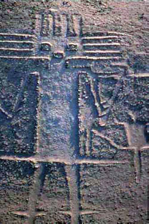

(This humanoid looking figure takes us to Ancient Star Travelers who visited Earth in the past)
Petroglyphs Images Carved into Rock Face
Pictographs or Pictograms Images Painted on Rock Face
Petroforms Human-made Boulder Forms
Geoglyphs are drawings or large motifs created on the ground - either by arranging clasts (stones, stone fragments, gravel or earth) to create a positive geoglyph (stone arrangement/alignment, petroform, earth mound) - or by removing patinated clasts to expose unpatinated ground formations.
These colossal earthworks are found on nearly every continent and bridge the gap between ancient art, engineering, and deep mystery. They and best viewed from above.
Many of the patterns are similar to those of petroglyphs carved into rock face.
Some of the most famous geoglyphs are part of Western Australia's Hill figures, turf mazes, and the stone-lined labyrinths of Scandinavia, Iceland, Lappland and the former Soviet Union.
It is impossible to know who made the different formations or whether they are real or artificial.
Mainstream archeologists suggest they served as sacred walking labyrinths, astronomical calendars aligned with the stars, maps to hidden water sources, other.
Today, scientists and archaeologists, working with computers and other technologies are discovering more geoglyphs, with striking similarities to each other, across the world. In other words, as with all things - the same iconology is used across the global game board with slight variations based on the civilization that created them.
Pseudoscience
Ancient astronaut theorists propose that geoglyphs were actually beacons for extraterrestrial visitors who created them with encoded messages that often follow specific geometric and algorithmic patterns found across the universe.
I believe in Simulation Theory - and that the simulation itself has created geoglyphs, crop circles, and other landscape art following the same algorithmic patterns of creation.
Sometimes I call it busy work for humans who are programmed to decipher messages and codes - trying to figure out the meanings behind the patterns then formulate that into something that unites the past and future.
Other times I feel there is something within the frequencies of the formations that aligns with the signature grids of specific individuals and allows them to remember who they are and why they are here as they continue their quest for answers - a "relief" from the chaos of physical reality.
The answer is simple. We exist in a simulated reality that had a beginning - and if you look at the world today - you understand or remember that it is coming to an end.
Subtle clues, symbols, archetypes are all around us. Whatever imagery your mind creates - has a basis in fact within the matrix of your design - clues that your programming has left for you about the journey of humanity in the alchemy of time.
It's written in stone.
(This humanoid looking figure takes us to Ancient Star Travelers who visited Earth in the past)
The Atacama Giant is an anthropomorphic geoglyph on the Cerro Unitas area of the Atacama Desert, Chile. At about 119 meters (390 feet), is the largest prehistoric anthropomorphic geoglyph. It has been suggested that the petroglyph represents a shaman, spiritual figure or deity, but there is little evidence to corroborate these claims.
The figure was an early astronomical calendar for knowing where the moon would set; by knowing this the day, crop cycle, and season could be determined. The points on the top and side of the head would say what season it would be depending on their alignment with the moon, which was important in determining when the rainy season would come in the barren Atacama.
The Atacama Giant is one out of nearly 5,000 geoglyphs - ancient artwork that is drawn into the landscape - that have been discovered in the Atacama region in the last three decades. It is believed that they are the work of several successive cultures that dwelt in this region of South America, including the Tiwanaku and Inca.

Band of Holes in Peru

Mysterious Circular Structure Found in Greece Stuns Archaeologists Science Alert - June 17, 2024
A remarkable 4,000-year-old ring-shaped stone monument has been discovered on a hill in the Greek island of Crete. The 1,800-square-meter (19,375-square-foot) Bronze Age structure was found at the top of Papoura Hill, northwest of the town of Kastelli, and was unearthed during excavation works for a major airport project.
The Uffington White Horse is a prehistoric hill figure, 110 m (360 ft) long, formed from deep trenches filled with crushed white chalk. It was created some time between 1380 and 550 BC, during the late Bronze Age or early Iron Age. The figure is situated on the upper slopes of Whitehorse Hill in the English civil parish of Uffington in Oxfordshire, some 16 km (10 mi) east of Swindon, 8 km (5.0 mi) south of the town of Faringdon and a similar distance west of the town of Wantage; or 2.5 km (1.6 mi) south of Uffington. The hill forms a part of the scarp of the Berkshire Downs and overlooks the Vale of White Horse to the north. The best views of the figure are obtained from the air, or from directly across the Vale, particularly around the villages of Great Coxwell, Longcot, and Fernham. Continue reading
The Uffington White Horse and Crop Circles BBC - August 23, 2024
Near the Uffington White Horse in Oxfordshire reports of mysterious patterns appearing in wheat, barley and corn fields in the area began to circulate in the 1970s, but it was in the late '80s that the phenomenon exploded.
Iconic Ancient Uffington White Horse -A Giant Chalk Figure Has Been Repaired Live Science - July 11, 2024
Last year, archaeologists with the National Trust realized that the chalk figure - located in Oxfordshire, England - was showing signs of decline. In particular, the neck and head of the 3,000-year-old horse figure were narrowing. As such, it was in need of some vital care. As such, a team of archaeologists from the National Trust and Oxford Archaeology have now restored the loss by cutting away the turf that has been slowly nibbling away at its shape over the years. The team has also redistributed some of the chalk that was on the top layer of the figure.
The Cerne Abbas Giant is a hill figure near the village of Cerne Abbas, in Dorset, England. Measuring 55 metres (180 ft) in length, the hill figure depicts a bald, nude male with a prominent erection, holding his left hand out to the side and wielding a large club in his right hand. Like many other hill figures, the Cerne Giant is formed by shallow trenches cut into the turf and backfilled with chalk rubble.
The origin and age of the figure are unclear, and archaeological evidence suggests that parts of it have been lost, altered or added, over time; the earliest written record dates to the late 17th century. Early antiquarians associated it, albeit on little evidence, with a Saxon deity, while other scholars sought to identify it with a Romano-British figure of Hercules (or some syncretization of the two). <> The lack of earlier descriptions, along with information given to the 18th-century antiquarian John Hutchins, has led some scholars to conclude it dates from the 17th century. On the other hand, recent optically stimulated luminescence testing has suggested an origin between the years 700 CE and 1110 CE, possibly close to the 10th-century date of the founding of nearby Cerne Abbey.
Regardless of its age, the Cerne Abbas Giant has become an important part of local culture and folklore, which often associates it with fertility. It is one of England's best-known hill figures and is a visitor attraction in the region. Continue reading
The Mysterious Origins Of The Cerne Abbas Giant May Finally Be Revealed IFL Science - January 3, 2024
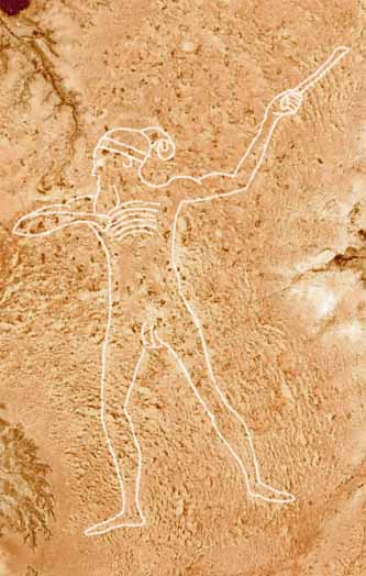
Marree Man in South Australia
The Marree Man, or Stuart's Giant, is a modern geoglyph discovered in 1998. It appears to depict an Indigenous Australian man hunting with a boomerang or stick. It lies on a plateau at Finnis Springs 60 km (37 mi) west of the township of Marree in central South Australia, approximately 12 km north-west of Callanna. It is just outside the 127,000-square-kilometre (49,000 sq mi Woomera Prohibited Area. The figure is 2.7 km (1.7 mi) tall with a perimeter of 28 km (17 mi), extending over an area of about 2.5 km2 (620 acres).
Although it is one of the largest geoglyphs in the world (arguably second to the Sajama Lines), its origin remains a mystery, with no one claiming responsibility for its creation nor any eye-witness having been found, notwithstanding the scale of the operation required to form the outline on the plateau floor.
The description "Stuart's Giant" was used in anonymous faxes sent to media as "Press Releases" in July 1998, in a reference to the explorer John McDouall Stuart. It was discovered fortuitously by a charter pilot in an overflight on 26 June 1998. Shortly after its discovery, the site was closed by the South Australian government following legal action taken in late July by native title claimants, but flights over the site were not forbidden as native title fell under federal government jurisdiction. Continue reading
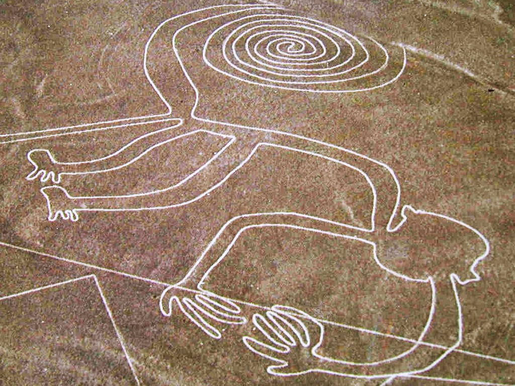
Nazca Lines of Peru
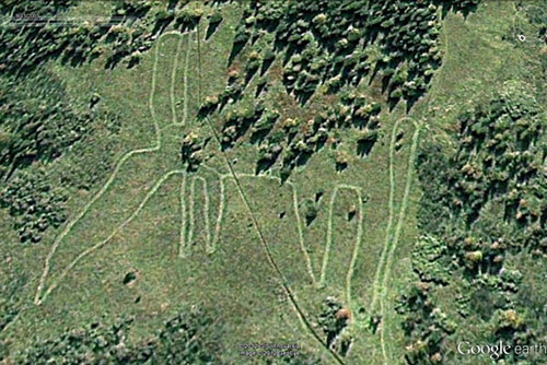
Elk-Shaped Geoglyph Found In Russia
Watch on Ancient Aliens
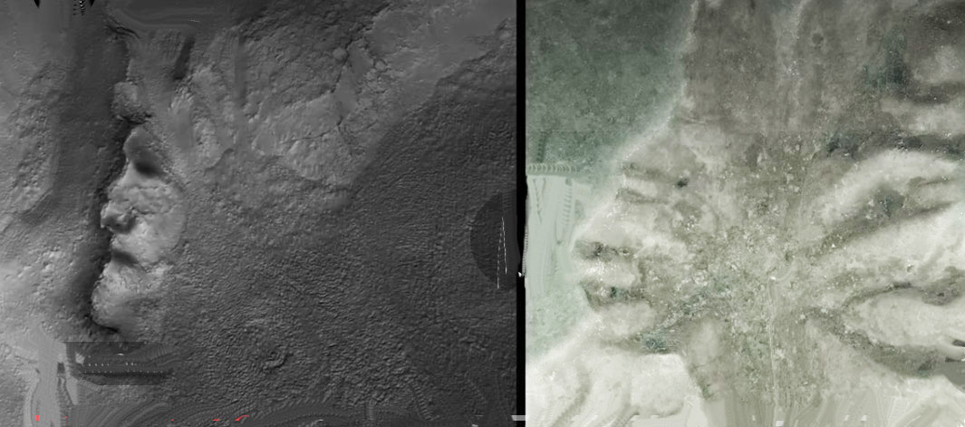
The Badlands Guardian is a geomorphological feature located near Medicine Hat in the southeast corner of Alberta, Canada. The feature was discovered in 2005 by Lynn Hickox through use of Google Earth.
Viewed from the air, the feature has been said to resemble a human head wearing a full Indigenous type of headdress, facing directly westward. An additional road and an oil well have been said to resemble a pair of earphones worn by the figure, which were installed in the early 2000s and are expected to disappear once the oil well is abandoned.
The head is a drainage feature created through erosion of soft, clay-rich stratum by the action of wind and water. The arid badlands are typified by infrequent but intense rain-showers, sparse vegetation and soft sediments. Although the image appears to be a convex feature, it is actually concave - and therefore, a valley, and is an instance of the Hollow-Face illusion. Its age is estimated to be in the hundreds of years at a minimum.
There also appears to be another face on the surface nearby in the terrain surrounding the Badlands Guardian location.
As with the face on Mars and other natural rock formations found on Mars and across the universe - one sometimes uses a technique called pareidolia or scrying wherein the human brain focuses on something that looks abstract and translates it into something familiar. The object in question can be anything but most often it's about cloud gazing and seeing detailed images.