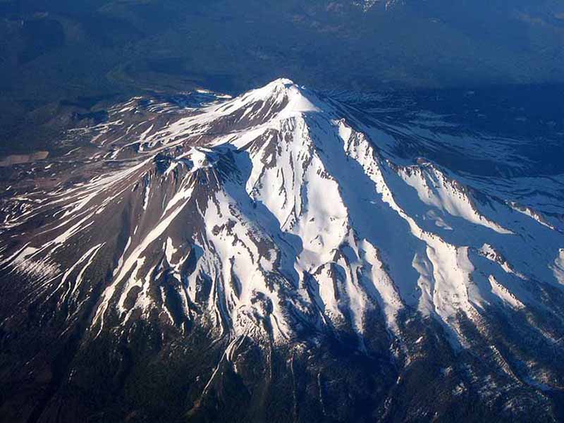
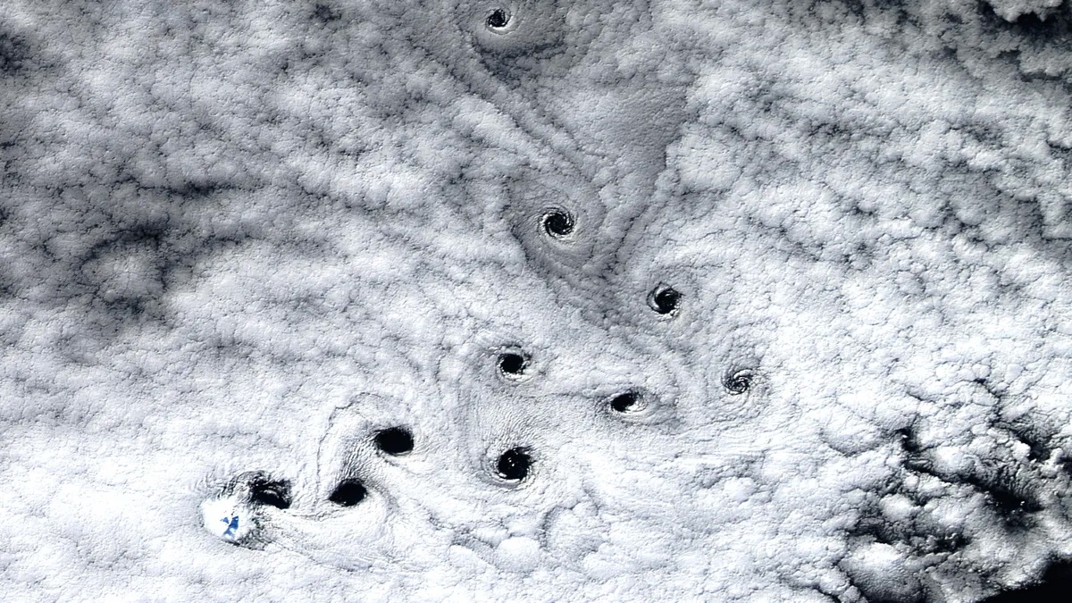
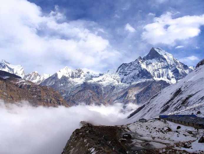
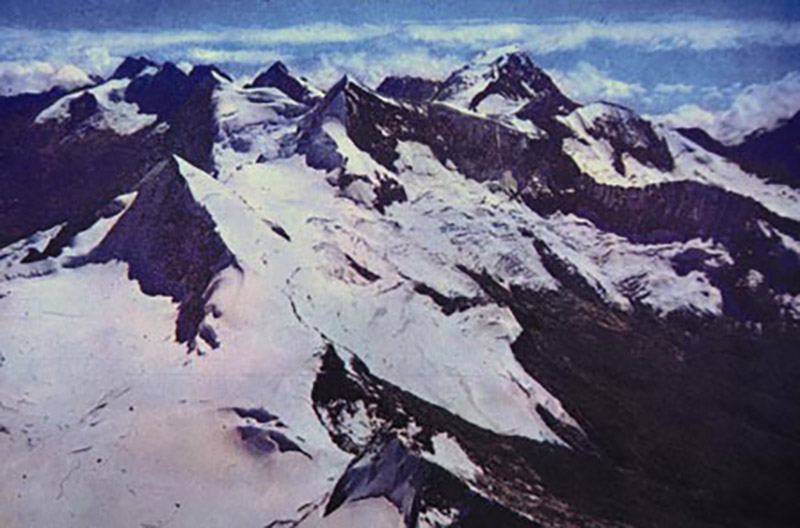
A mountain is a large landform that stretches above the surrounding land in a limited area, usually in the form of a peak. A mountain is generally steeper than a hill. Mountains are formed through tectonic forces or volcanism. These forces can locally raise the surface of the earth. Mountains erode slowly through the action of rivers, weather conditions, and glaciers. A few mountains are isolated summits, but most occur in huge mountain ranges.
High elevations on mountains produce colder climates than at sea level. These colder climates strongly affect the ecosystems of mountains: different elevations have different plants and animals. Because of the less hospitable terrain and climate, mountains tend to be used less for agriculture and more for resource extraction and recreation, such as mountain climbing.
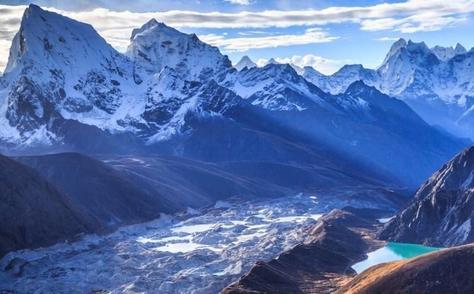
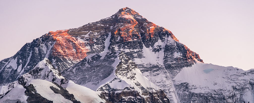
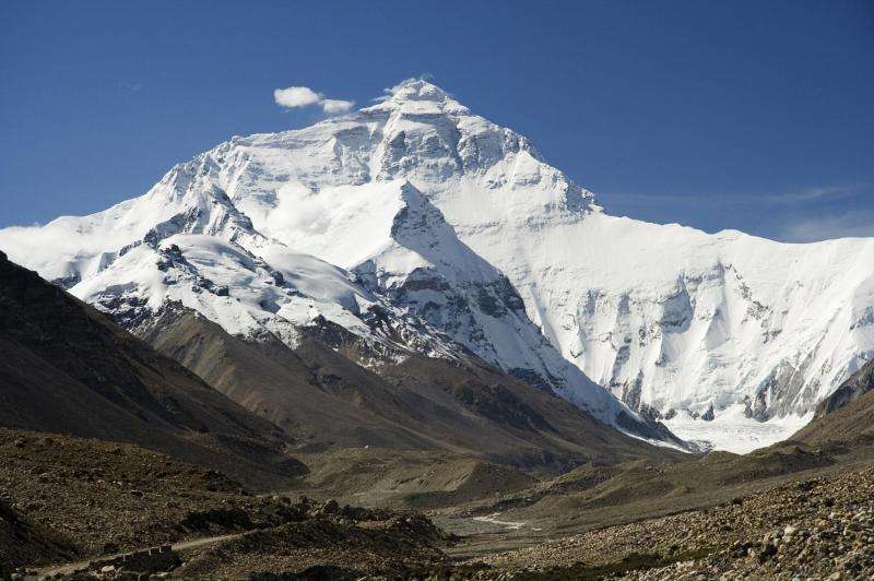
The highest mountain on Earth is Mount Everest in the Himalayas of Asia, whose summit is 8,850 m (29,035 ft) above mean sea level. The highest known mountain on any planet in the Solar System is Olympus Mons on Mars at 21,171 m (69,459 ft). Read more
Mountains symbolize a nearness to God and creation as they extend toward the sky. Questions are asked and answers often telepathically given by an unseen force a.k.a. the consciousness grids that create the illusion of reality in the simulation of time.
When you look back at some of the greatest prophets in history - they were guided to climb a mountain where they were given their soul's purpose by an 'enigmatic figure' they believed was God. In today's world, these experiences could be understood as projected illusions connecting humans with extraterrestrials or the consciousness quiz to help humanity in one way or another.
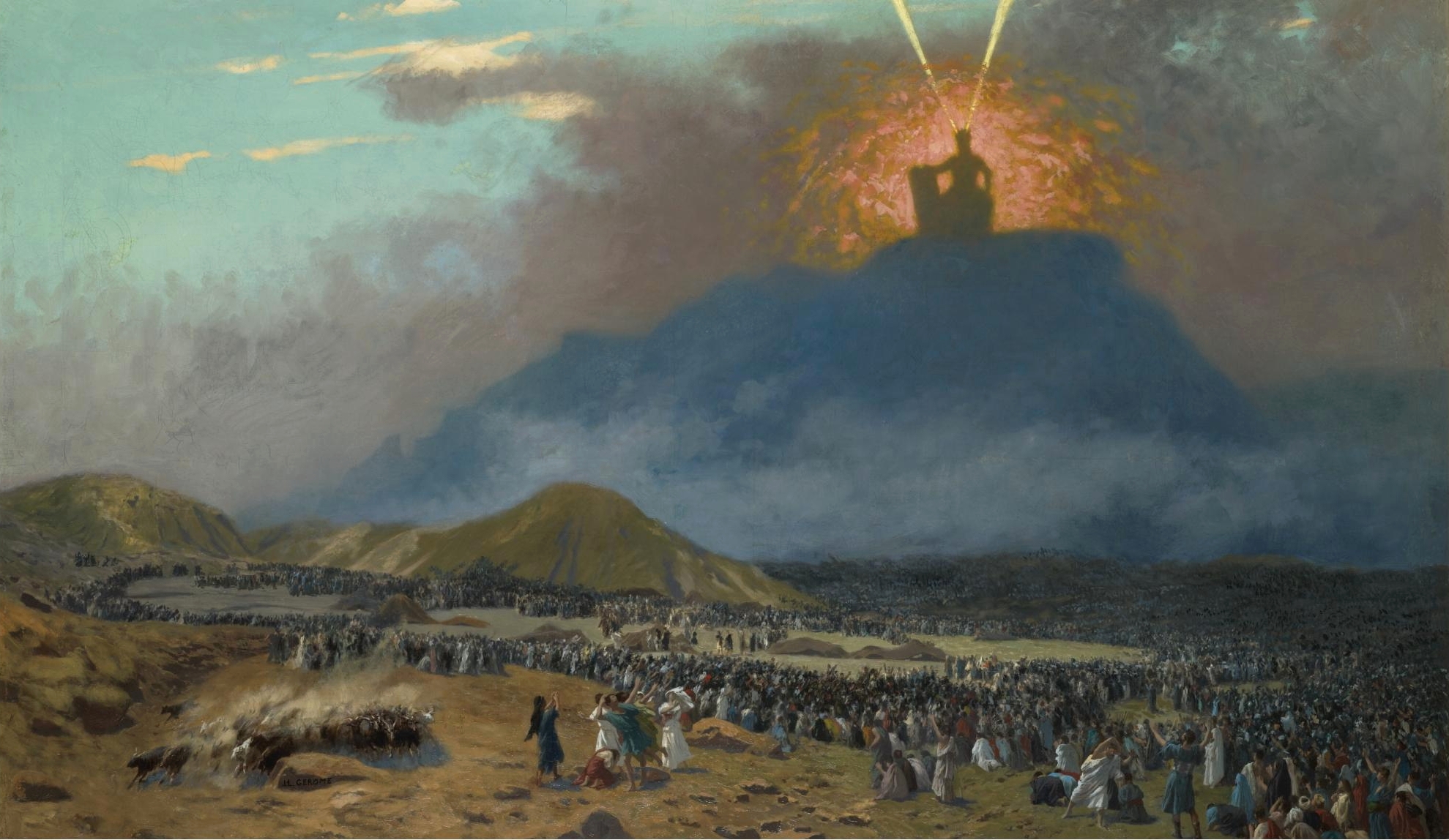
A well-known story/myth is the journey of Moses who climbed a mountain - today known as Mount Sinai (Horeb or Moses) - to meet with God in the form of a burning bush - after which he returned with the Seven Commandments.
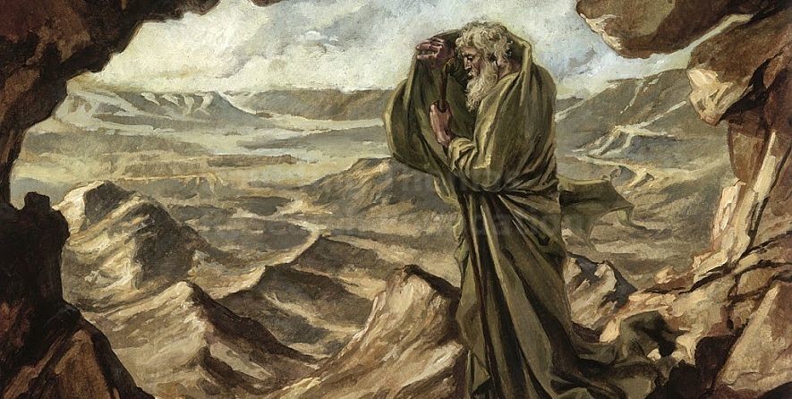
Another famous encounter on Mt. Sinai was that of the prophet Elijah.
Today people are drawn to spiritual locations to find meaning in life. Many of these places, resemble a mountain, a pyramid, a stupa or the like. They are often found where powerful Earth grid intersect and the energies are high.
Part of the experience, which is sometimes seen as an initiation, is climbing a mountain or another similar object - returning with stories of paranormal sightings and experiences in which they are given telepathic messages given by whoever they are programmed to encounter. Always, the purpose is to change one's destiny in a positive way.
There are physiological changes that occur in the human brain and body that add to the experience of connecting one's consciousness from physical reality to the consciousness grids that create the illusion of reality in the simulation of time.
If you watch the History Channel series "Ancient Aliens" they often mention a connection between UFOs, anomalous sightings on famous mountains, and ancient myths around the world.
These mountains seem to be located on major grid points of energy. They are connected to underground bases where extraterrestrials allegedly reside - coming and going in UFOs or through portals which one can assume open and close with some sort of a technological device. UFO are also seen entering and existing volcanoes such as Mount Popocatepetl in Mexico.
As of 2008 the Human Experiment ended and extraterrestrials left. UFO sightings are drones monitoring the planet until the Simulation of reality ends in the near future.
Mount Archuleta- Dulce Base is the subject of a conspiracy theory claiming that a jointly-operated human and alien underground facility exist under Archuleta Mesa on the Colorado-New Mexico border near the town of Dulce, New Mexico.
Claims of alien activity there first arose from Albuquerque businessman Paul Bennewitz. When I first posted Crystalinks in 1995 I spoke with Paul's family and told them I believed him and blogged about it. They were very grateful about the positive things I reported.
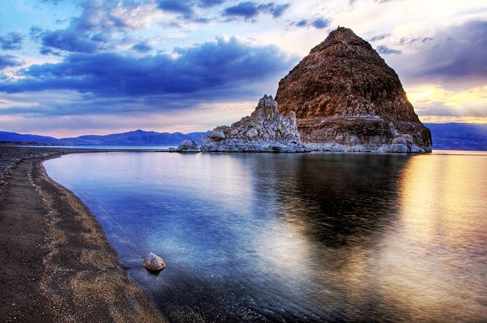
On a 1998 road trip to retrace my 1954 alien abduction experience at Pyramid Lake, Nevada, I had a unique experience that aligns with the Dulce Base storyline.
While walking alone - a Native American elder came up to me seemingly out of nowhere.
He never told me his name but I asked if I could call him, Joseph, which seemed like the right name at the moment - though not necessarily a Native American name. He agreed.
I wanted to record our conversation, but he refused and would not allow photos. I agreed.
His words were powerful, his energies spiritual, his features rugged, his eyes at times staring into mine as if seeing right through me.
He told me that he knew who I was and that I had a powerful destiny as a great teacher. I didn't understand what he meant at the time because this was years before the Internet and Crystalinks, but this was not the first time I had been told that.
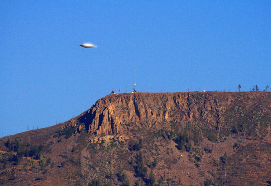
Joe pointed to a nearby mountain and told me that aliens live and work below - coming and going in spaceships often seen by the locals.
He spoke about UFO retrievals, government projects and military bases hidden within the mountains camouflaged from the rest of the world - places where he and others had worked for several years on secret projects - which we call reverse engineering of UFOs.
He knew nothing about my 1954 experience, though he said that his people had worked on government projects as far back as that date and was aware that sometimes humans were taken the reasons not always sinister.
I don't know how long we spend together in the desert before parting company.
The last thing Joe told me was, "The time will come when people will learn the truth about what has remained hidden for decades. There are many who know and will one day come forth to bring wisdom at a time when all will change forever."
Ellie Meets a Gray Alien named Solux on a mountain in Sedona, AZ
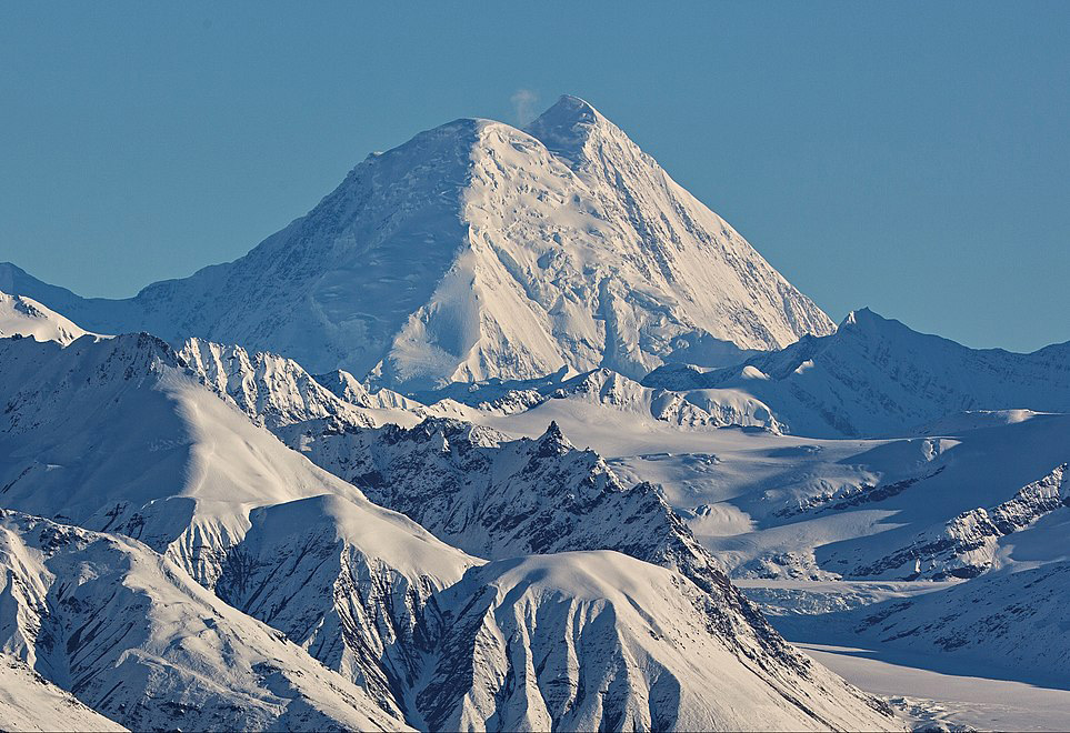
Mount Hayes is the highest mountain in the eastern Alaska Range. Beneath the mountain is allegedly a black (dark) pyramid which might be a power plant..
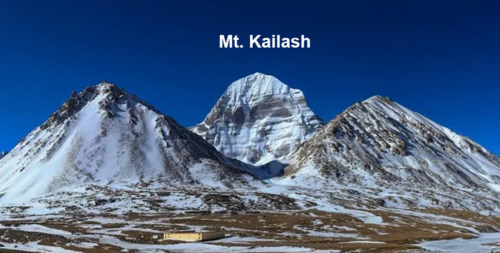
Mount Kailash is found in the Tibet Autonomous Region of China. According to Ancient Alien Theorists it is a gateway to legendary Shambala where kings live for thousands and use UFOs or Vimanas as transportation - as told by locals over many centuries. In Hinduism, the mountain is traditionally recognized as the home of Shiva, who resides there with his consort goddess Parvati and their children, Ganesha and Kartikeya.
Crystalinks' readers know - we exist in a simulation which makes me wonder if the article in the news below has anything to do with an extraterrestrial agenda as our simulation closes. The extraterrestrials presence on Earth ended in 2008 leaving behind drones and other instrumentation that monitor the planet till the end.
Indian Tectonic Plate Is Splitting in Two Beneath Tibet, Latest Analysis Finds Science Alert - January 17, 2024
Combined with a fresh look at previous research, a recent analysis of new seismic data collected from across southern Tibet has delivered a surprising depiction of the titanic forces operating below the Himalayas.
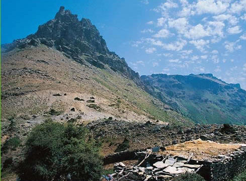
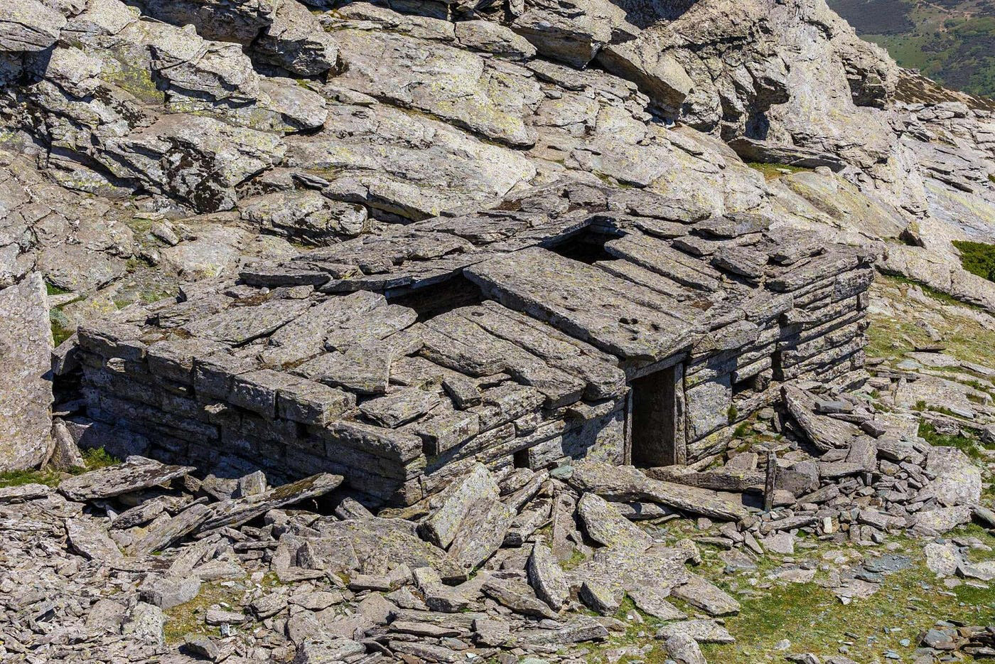
Ochi is a mountain in the southeastern most part of the island of Euboea, Greece. It is one of the largest mountains in all of Greece. According to legend a Dragon House - a giant megalithic structure - was built on top of Mount Ochi to venerate the arrival of extraterrestrial travelers - dragon referring to their spaceships that spewed fire.

Mount Musine is a mountain in the Graian Alps in the Metropolitan City of Turin, Piedmont, north Italy. Musine is well known for the high cross on its peak, as well as for being the mountain closest to Turin.
According to Ancient Aliens - Mount Musine has stood at the unique crossroads of history as a mysterious phenomenon. There have been all kinds of unexplained occurrences on this mountain since the beginning. There's a touch of magic connected to the Mountain. Floating lights have been seen over thousands of years continuing to this day. Local legend passed down from ancient times - says that in the fourth century AD the Emperor Constantine saw a cross of light floating in the sky over the mountain inspiring him to convert the empire into Christianity.
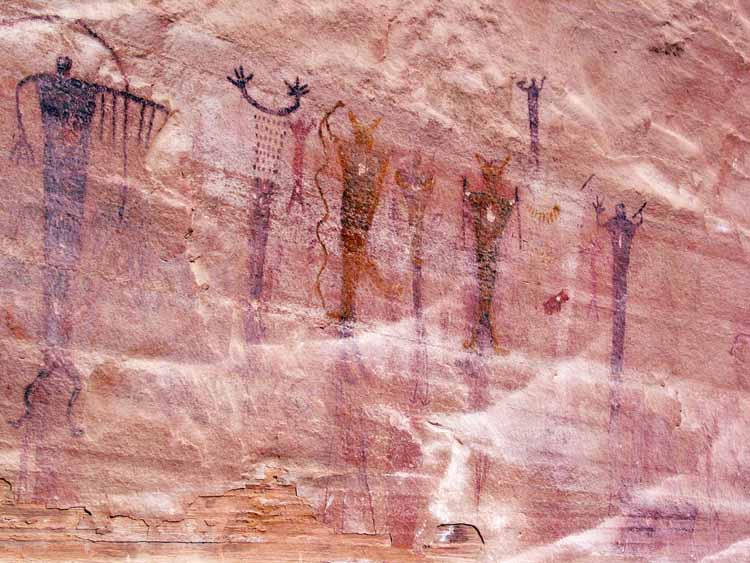
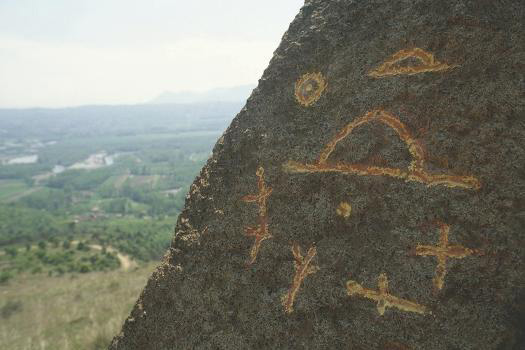
Rock Art is found on mountains around the world
Geologists Unearth a Colossal Copper, Gold, and Silver Deposit: The Biggest Mineral Discovery in 30 Years, Worth $424 Billion Daily Galaxy - April 22, 2026
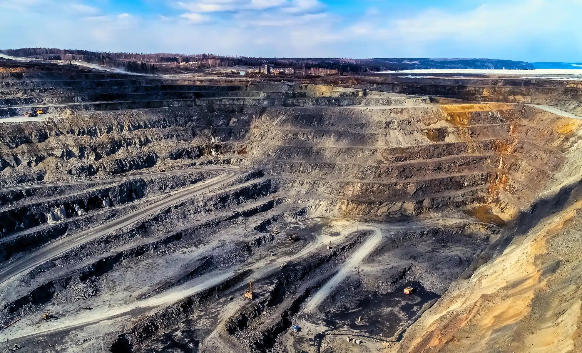
A Canadian miner and one of the world's biggest resource groups are preparing to invest nearly $18 billion in a copper deposit in the Andes that could become the fifth-largest producing mine on Earth if development proceeds as planned. The Vicuna project, straddling the Argentina-Chile border above 4,500 meters, contains 14 million tons of measured and indicated copper, 36 million ounces of gold, and 729 million ounces of silver.
South Africa: At 2.7 Billion Years Old, This Mountain Holds 40% of All Gold Ever Mined and Still Holds Half a Trillion Dollars Daily Galaxy - March 2, 2026
Some geological formations reshape continents. Others reshape economies. In South Africa, the Witwatersrand Basin belongs to both. Its rocks formed roughly 2.7 billion years ago, during the Archean Eon, when Earth’s crust was still stabilizing and the atmosphere held little oxygen. Today, the ridges outside Johannesburg appear dry and unremarkable, broken by highways, neighborhoods, and the skeletal frames of old mining towers. Nothing at the surface hints at the scale of what lies beneath.
Scientists Stunned by Marine Fossils Found at the Peak of Mount Everest, Here’s Why! Daily Galaxy - January 9, 2026

What if we told you that Mount Everest was once underwater? The discovery of marine fossils at its summit has scientists scratching their heads. Recently, a video showing people collecting marine fossils from the summit of a mountain went viral, leaving many puzzled. Some even jumped to conclusions, suggesting the fossils were proof of the biblical great flood. But there's a much simpler and scientifically backed. The presence of marine fossils at high altitudes is not only fascinating, it also gives us a glimpse into how Earth's landscape has changed over millions of years. While some people might assume these fossils are the result of a sudden catastrophe, like a massive flood, the truth lies in plate tectonics, a scientific theory that explains the shifting of Earth's surface. And it turns out that the answer is all about ancient seas and the movement of Earth's crust.
'Enormous' mountain on Pacific seafloor rivals Rocky Mountain peaks, NOAA says PhysOrg - September 12, 2025
The seamount is 250 miles north of Palau - an island country east of the Philippines—and multibeam sonar revealed its peak is hidden about 800 feet below the surface.
The geology that holds up the Himalayas - the world's highest mountain range and home to Mount Everest - is not what we thought, scientists discover Live Science - September 1, 2025
A new study reveals there is a piece of mantle sandwiched between the Asian and Indian crusts. This explains why the Himalayas grew so tall, and how they still remain so high today,
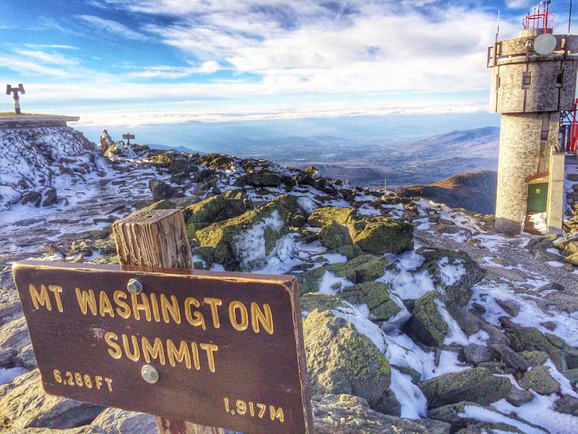
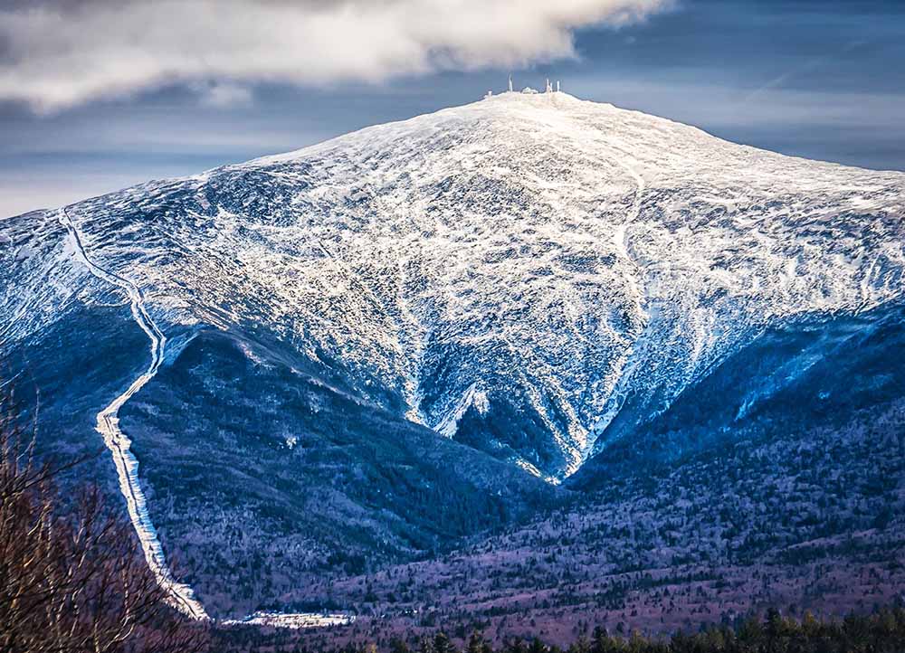
Mount Washington is home to the world's worst weather with record wind speeds of 231 mph Live Science - March 14, 2025
Earth beneath Washington state has been shaking - experts are on high alert. The largest active volcano in the state sits there - and researchers are worried it could blow MSN - March 14, 2025
Mysterious Pink Sands in Australia Reveal Hidden Antarctic Mountains Science Alert - June 22, 2024
Joining the dots with ice-flow indicators in the South Australian glacial sedimentary rocks that garnet-rich glacial sands were ground out of the Antarctic mountains - which are yet to see the light of day - by an ice sheet moving north-west during the Late Palaeozoic Ice Age, when Australia and Antarctica were connected in supercontinent Gondwana.
Indian Tectonic Plate Is Splitting in Two Beneath Tibet, Latest Analysis Finds Science Alert - January 17, 2024
Combined with a fresh look at previous research, a recent analysis of new seismic data collected from across southern Tibet has delivered a surprising depiction of the titanic forces operating below the Himalayas. Presenting at the American Geophysical Union conference in San Francisco last December, researchers from institutions in the US and China described a disintegration of the Indian continental plate as it grinds along the basement of the Eurasian tectonic plate that sits atop it.
600-Million-Year-Old Time Capsule Of Ancient Ocean Found In The Himalayas IFL Science - August 2, 2023
Drops of water found inside mineral deposits are the remnants of an ocean that disappeared 600 million years ago. Remarkably, the best place to find the minerals in question is kilometers above sea level. The scientists who found them say the droplets may explain a much-debated event crucial to life as we know it.
Drops of seawater found to contain traces of an ancient world PhysOrg - August 2, 2023
Sea salt hides a secret: tiny droplets of the seawater from which it came, preserving geologic history. To access the tiny droplets, the researchers used a laser to drill holes into the salt crystals and then a mass spectrometer to analyze the different trace elements present. In this research, they focused specifically on the concentration of lithium, a trace element that sustained a seven-fold decrease over the past 150 million years, paralleled by a rise in magnesium to calcium ratios.
Mount Everest Makes Some Horrifying Sounds At Night IFL Science - May 4, 2023
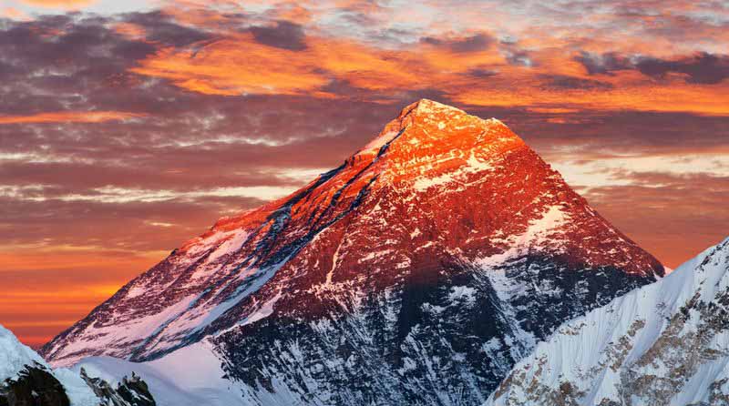
Standing at a height of 8,848 meters (29,029 feet) above sea level, Mount Everest is the planet's highest peak (though not strictly the highest mountain). Having claimed over 300 lives so far, climbing this mountain is already a daunting concept, but even more so once you hear the eerie groans it makes in the night.
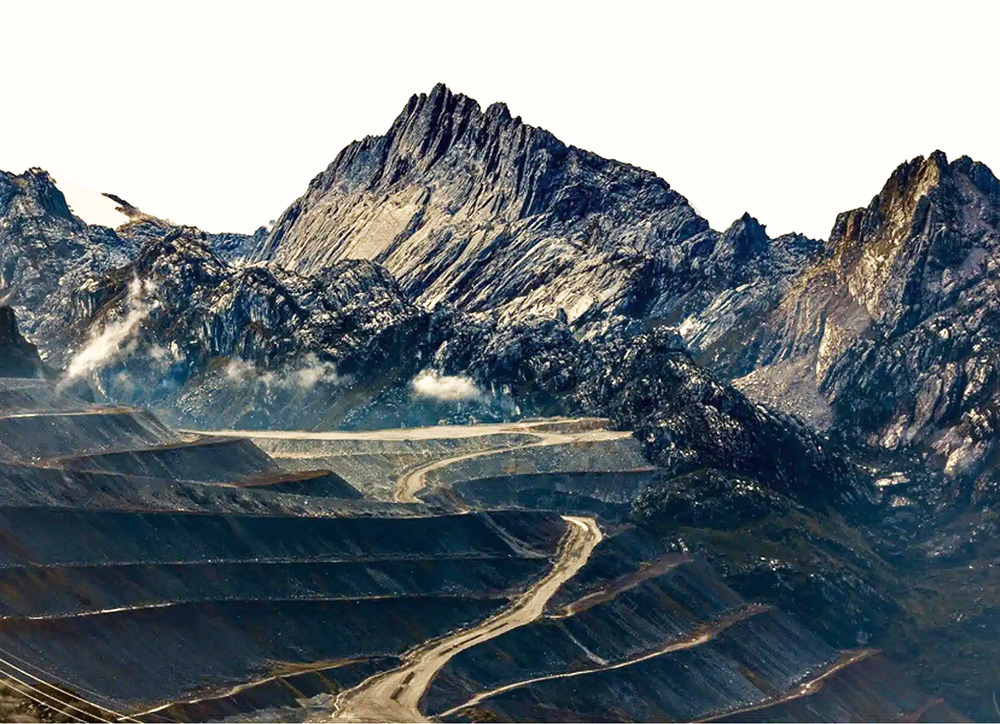
Scientists May Have Solved The Mystery of How The Andes Got So Big Science Alert - April 23, 2023
The answer: Plate tectonics - the movement of great slabs of Earth's crust across the planet - can create mountain ridges as slower sections are forced up by faster moving regions. Though the concept is simple in theory, tracking the speed of tectonic movements across timescales shorter than 10 to 15 million years in duration is tricky for geologists.
Video: Peru's Rainbow Mountain Offers Incredible Natural Wonder Weather.com - February 7, 2023
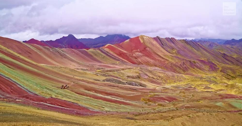
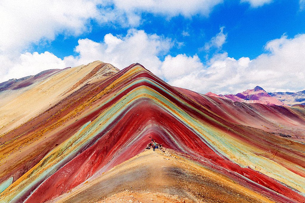
Vinicunca, or the Rainbow Mountain, was revealed in 2015 when warmer temperatures melted the ice that was covering it. Now it's quickly becoming one of the country's most popular attractions. Vinicunca is a mountain in the Andes of Peru. According to the Cultural Landscape Office of the City of Cusco, the seven colors of the mountain are due to its mineralogical composition: the pink color is due to red clay, fangolitas (mud) and arilitas (sand); the whitish coloring is due to quartzose, sandstone and marls, rich in calcium carbonate; the red is due to claystones (iron) and clays belonging to the Upper Tertiary period; the green is due to phyllites and clays rich in ferro magnesian; the earthy brown is a product of fanglomerate composed of rock with magnesium belonging to the Quaternary period; and the mustard yellow color comes from the calcareous sandstones rich in sulphurous minerals. Continue reading
Scientists discover lost range of 'supermountains' three times longer than the Himalayas Live Science - February 4, 2022
Giant mountain ranges at least as high as the Himalayas and stretching up to 8,000 kilometers across entire supercontinents played a crucial role in the evolution of early life on Earth. Twice in our planet's history, colossal mountain ranges that towered as tall as the Himalayas and stretched thousands of miles farther reared their craggy heads out of the Earth, splitting ancient supercontinents in two. Geologists call them the "supermountains."
Supermountains controlled the evolution of life on Earth PhysOrg - February 3, 2022
The researchers tracked the formation of these supermountains throughout Earth's history using traces of zircon with low lutetium content - a combination of mineral and rare earth element only found in the roots of high mountains where they form under intense pressure. The study found the most giant of these supermountains only formed twice in Earth's history - the first between 2,000 and 1,800 million years ago and the second between 650 and 500 million years ago. Both mountain ranges rose during periods of supercontinent formation.
Human-induced climate change impacts the highest reaches of the planet - Mount Everest PhysOrg - February 3, 2022
Melting and sublimation on Mount Everest's highest glacier due to human-induced climate change have reached the point that several decades of accumulation are being lost annually now that ice has been exposed, according to a University of Maine-led international research team that analyzed data from the world's highest ice core and highest automatic weather stations. The extreme sensitivity of the high-altitude Himalayan ice masses in rapid retreat forewarns of quickly emerging impacts that could range from increased incidence of avalanches and decreased capacity of the glacier stored water on which more than 1 billion people depend to provide melt for drinking water and irrigation. At the rate at which the highest glaciers are disappearing, Mount Everest expeditions could be climbing over more exposed bedrock, potentially making it more challenging to climb as snow and ice cover continues to thin in the coming decades.
Mount Everest is Earth's highest mountain above sea level, located in the Mahalangur Himal sub-range of the Himalayas. The China-Nepal border runs across its summit point. Its elevation (snow height) of 8,848.86 m (29,031.7 ft) was most recently established in 2020 by the Chinese and Nepali authorities.
The 'Somalaya Mountains' Might Be The Biggest Mountain Range You'll Never Get to See Science Alert - December 27, 2021
Paleogeographic reconstructions like these provide context to study the processes that shape our planet: the Earth's engines of plate tectonics, volcanism, and mountain building, and their interactions with the oceans, atmosphere, and sun that shape climate and life. In the past ten years, software has been developed that means anyone who is interested can make these reconstructions.
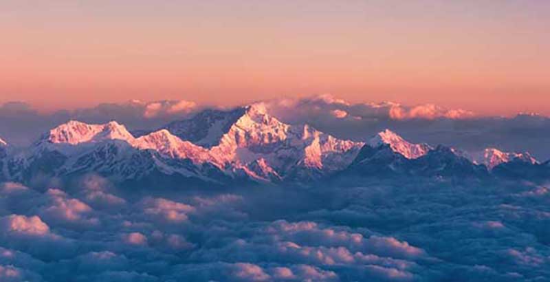
Kangchenjunga is the third highest mountain in the world. Its summit lies at 8,586 m (28,169 ft) in a section of the Himalayas, the Kangchenjunga Himal, which is bounded in the west by the Tamur River, in the north by the Lhonak River and Jongsang La, and in the east by the Teesta River.
Is Mount Everest really the tallest mountain on Earth? Live Science - December 27, 2021
It's no secret that Mount Everest, the jewel in Nepal's Himalayan crown, is the world's premier mountain. It's one of those facts embedded in childhood, like knowing that Neil Armstrong was the first person to walk on the moon or that blue whales are the largest animals ever to have lived. You may be surprised to hear, then, that other peaks could conceivably be considered Earth's tallest; it just depends how you measure them.
Earth's Ancient Mountains Rose Up With Help From The Ocean's Tiniest Organisms Science Alert - November 30, 2021
Without an explosion in ocean life more than 2 billion years ago, many of Earth's mountains might never have formed, according to new research. When tiny organisms in the shallows of the sea, like plankton, die and sink to the bottom, they can add organic carbon to Earth's crust, making it weaker and more pliable.
Andes - Birthplace of Earth's Continents Discovered Under These Mountains Live Science - January 31, 2019
Earth's continents may have been born under large mountain ranges like the Andes. New research combining a mysterious missing trace element, a 66-million-year-old rock burped up by an ancient volcano, and a database of all the rock chemistry analyzed by scientists in the past century explains why Earth has continents. A study suggests that where mountains are born, so are continents.
The Andes, Andes Mountains or Andean Mountain Range are the longest continental mountain range in the world, forming a continuous highland along the western edge of South America. The Andes extend from north to south through seven South American countries: Venezuela, Colombia, Ecuador, Peru, Bolivia, Chile, and Argentina. Along their length, the Andes are split into several ranges, separated by intermediate depressions.
How A Fake Mountain Range Slowed Down Arctic Exploration Atlas Obscura - March 9, 2018
On August 31, 1818, the Arctic explorer John Ross was called away from his dinner and onto the deck of the ship he commanded, the Isabella. Ross and his crew were moored in Baffin Bay, just south of Greenland, seeking a way through to the Arctic sea beyond. All day, they had been waiting for the fog to clear, so they could take a look around and try to find it. Ross stepped out onto the deck and began scanning the horizon: ice, more ice, and, in between, an imposing set of peaks. I distinctly saw the land, round the bottom of the bay, forming a connected chain of mountains with those which extended along the north and south sides, he wrote soon after. There was, he concluded, no way through.
Andes Glaciers Vanishing Rapidly, Study Finds Live Science - January 22, 2013
The glaciers of the Andes Mountains have retreated at an unprecedented rate in the past three decades, with more ice lost than at any other time in the last 400 years. That's according to a new review of research that combines on-the-ground observations with aerial and satellite photos, historical records and dates from cores of ice extracted from the glaciers. The retreat is worse in the Andes than the average glacier loss around the world.
Undersea mountains march into the abyss BBC - December 6, 2011
Startling new images from the depths of the Pacific Ocean reveal one of Earth's most violent processes: the destruction of massive underwater mountains. The pictures were created by sonar in waters up to 6km (4mi) deep. They expose how tectonic action is dragging giant volcanoes into a chasm in the seabed. The volcanoes are strung across several thousand kilometres of ocean floor and are moving westward on the Pacific tectonic plate at up to 6cm per year. The extraordinary scene was captured along the Tonga Trench during a research expedition last summer.
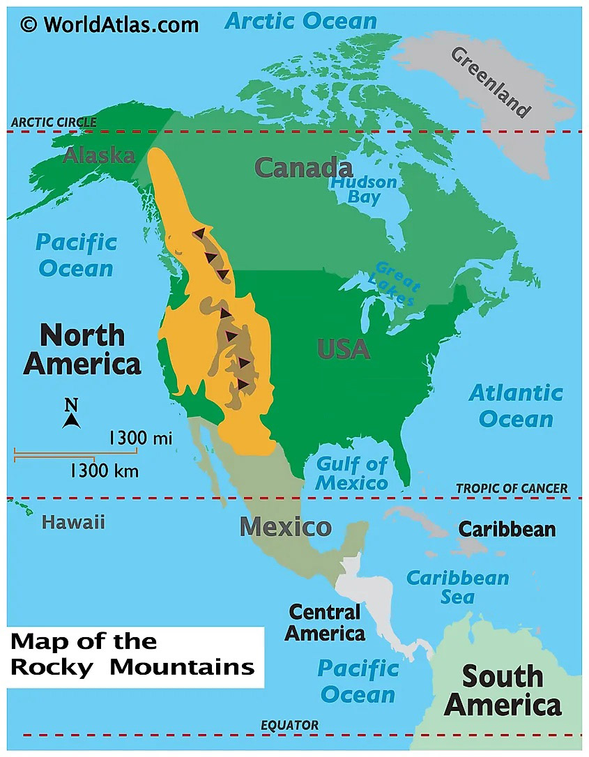
New insights on the origin of the Rocky Mountains PhysOrg - March 1, 2011
The formation of the Rocky Mountains in Colorado has always puzzled scientists. Some 600 miles inland and far removed from the nearest tectonic plate, the only comparable inland mountain range is the Himalaya, which scientists deduced were formed by the collision of the Indian plate with the Eurasian plate.
The Rocky Mountains, also known as the Rockies, are a major mountain range and the largest mountain system in North America. The Rocky Mountains stretch 3,000 miles (4,800 kilometers) in straight-line distance from the northernmost part of western Canada, to New Mexico in the southwestern United States. Depending on differing definitions between Canada and the U.S., its northern terminus is located either in northern British Columbia's Terminal Range south of the Liard River and east of the Trench, or in the northeastern foothills of the Brooks Range/British Mountains that face the Beaufort Sea coasts between the Canning River and the Firth River across the Alaska-Yukon border. Its southernmost point is near the Albuquerque area adjacent to the Rio Grande rift and north of the Sandia–Manzano Mountain Range. Being the easternmost portion of the North American Cordillera, the Rockies are distinct from the tectonically younger Cascade Range and Sierra Nevada, which both lie farther to its west.
The Rockies formed 80 million to 55 million years ago during the Laramide orogeny, in which a number of plates began sliding underneath the North American plate. The angle of subduction was shallow, resulting in a broad belt of mountains running down western North America. Since then, further tectonic activity and erosion by glaciers have sculpted the Rockies into dramatic peaks and valleys. At the end of the last ice age, humans began inhabiting the mountain range. After explorations of the range by Europeans, such as Sir Alexander Mackenzie, and Anglo-Americans, such as the Lewis and Clark Expedition, natural resources such as minerals and fur drove the initial economic exploitation of the mountains, although the range itself never experienced a dense population
Earth's highest coastal mountain on the move PhysOrg - September 20, 2010
The Earth's highest coastal mountain, Colombia's Sierra Nevada moved north from Peru and rotated to form a new basin. The rocks of Colombia's Sierra Nevada de Santa Marta the highest coastal mountain on Earth tell a fascinating tale: The mountain collides and then separates from former super-continents. Volcanoes are born and die. The mountain travels from Peru to northern Colombia and finally rotates in a clockwise direction to open up an entirely new geological basin.
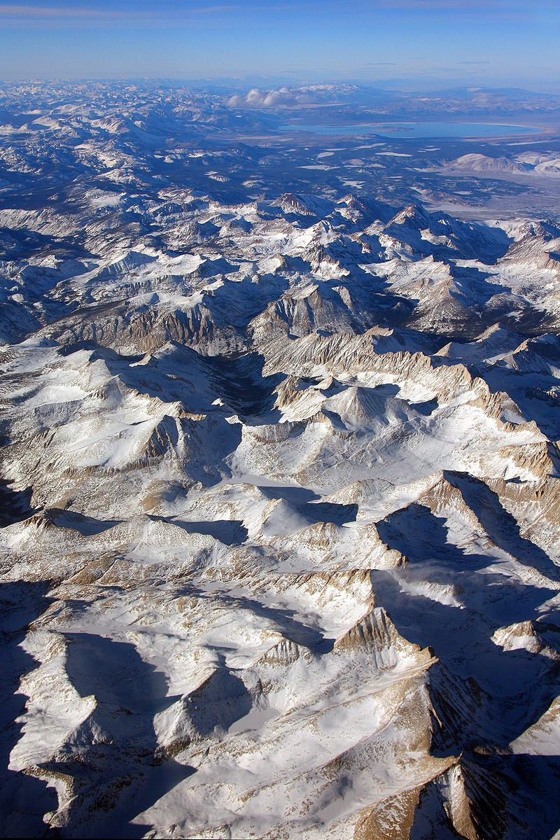
Sierra Nevada is a mountain range in the Western United States, between the Central Valley of California and the Great Basin. The vast majority of the range lies in the state of California, although the Carson Range spur lies primarily in Nevada. The Sierra Nevada is part of the American Cordillera, an almost continuous chain of mountain ranges that forms the western "backbone" of the Americas. The Sierra runs 400 miles (640 km) north-south and its width ranges from 50 miles (80 km) to 80 miles (130 km) across east–west.
Data to expose 'ghost mountains' BBC - December 19, 2009
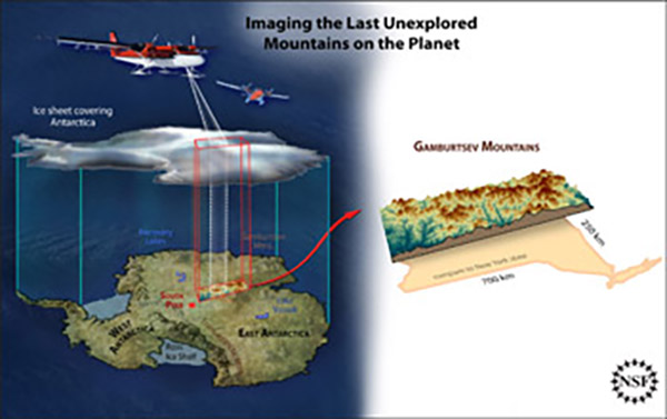
Scientists who mapped one of the most enigmatic mountain ranges on Earth have given a first glimpse of their data. An international team spent two months in 2008/9 surveying the Gamburtsevs in Antarctica - a series of peaks totally buried under the ice cap.The group has told a major conference in the US that the hidden mountains are more jagged than previously thought. They are also more linear in shape than the sparse data collected in the past had suggested. This latter finding hints at a possible origin for the mountains whose existence has perplexed scientists for 50 years.
The Gamburtsev Mountain Range (also known as the Gamburtsev Subglacial Mountains) is a subglacial mountain range located in East Antarctica, just underneath the lofty Dome A, near the Southern Pole of Inaccessibility. The range was discovered by the 3rd Soviet Antarctic Expedition in 1958 and is named for Soviet geophysicist Grigoriy A. Gamburtsev.
It is approximately 1,200 kilometres (750 mi) long, and the mountains are believed to be about 2,700 metres (8,900 ft) high, although they are completely covered by over 600 metres (2,000 ft) of ice and snow. The Gamburtsev Mountain Range is about the same size as the European Alps. As of 2008, it was unknown how the mountains were formed due to the lack of data. Studies conducted during the International Polar year demonstrated that ancient plate collisions produced a core that was rejuvenated in the early to mid-Mesozoic. The main features of the range formed before 34 million years ago, when the area was covered by the present ice sheet. Current models suggest that the East Antarctic ice sheet was formed from the glaciers that began sliding down the Gamburtsev range at the end of the Eocene. Vostok Subglacial Highlands form an east extension of Gamburtsev Subglacial Mountains.
Snow at Highest Elevations No Longer Pure Live Science - December 10, 2009
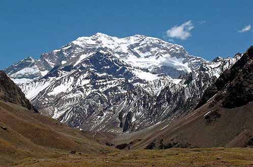
The pure white snow atop the Andes Mountains may not be so pure after all. Scientists have found traces of toxic pollutants called PCBs in snow samples taken from Aconcagua Mountain, the highest peak in the Americas.
Andes mountains: White, but not pure PhysOrg - December 7, 2009
The snow on Aconcagua Mountain in the Andes is polluted with PCBs. An international team of researchers detected low concentrations of these toxic, carcinogenic chlorine compounds in samples taken from America's highest mountain. The snow samples taken at an altitude of 6200 metres are among the highest traces found anywhere in the world of these substances, which have been banned since 2001.